SEARCH
Roundtrip: 14.4 miles
Difficulty: difficult
Elevation Gain: 2900 feet
High Point: 5245 feet
Best Season: summer through fall
Trail Notes: Access is via a gated private timber road that is periodically subject to closing (usually during high fire danger). Trail is also open to mountain bikes and horses (but their use is light). Practice leave no trace principles
Trail Highlights: Old growth forest, views, wildflowers, waterfalls, wildlife observation, solitude, backpacking opportunities
Directions to Trailhead: From Morton travel east on US 12 for 5.3 miles turning right at Milepost 103 onto Kosmos Road. After 0.1 mile turn left onto the Champion Haul Road and continue 4.3 miles (passing Taidnapum Park) to bridge over Cowlitz River. Turn right onto gravel forest road and after 0.8 mile bear left at a Y-junction onto FR 2750. Follow this road 4.0 miles to its end at trailhead.
Tumwater means waterfall in the Chinook jargon. The city of Tumwater just south of Olympia is home to a showy roaring tumwater along the Deschutes River. Tumwater Canyon just to the west of Leavenworth cradles a roilng, tumbling, cascading Wenatchee River. Tumwater Mountain in the far north of the Mount St Helens National Volcanic Monument is a long lonely peak shrouded in old-growth forest.
Explore this little hiked peak hovering above the confluence of the Cowlitz and Cispus Rivers and you’ll be immersed in a wilderness far from roaring water. Soft breezes whistle through its miles of unbroken forests. Thrush and wren song break the silence of its still mornings. Much of the ridge is waterless except for a small little lake below the mountain’s summit.
Tumwater Mountain seems misnamed. Perhaps it was named after the large falls that once tumbled on the Cowlitz River before the Cowlitz Falls Hydroelectric Dam tamed them. Tumwater Creek flows down from the mountain to meet the Cowlitz just below the falls site. And while the glacier-fed Cowlitz River has been greatly altered over the years, remarkably Tumwater Mountain remains wild and unblemished. This peak and its eastern slopes encompassing the Goat Creek Drainage were added into the Mount St Helens National Volcanic Monument in 1982.
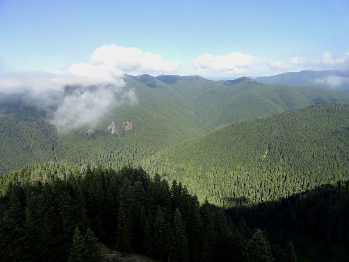
Tumwater Mountain like nearby Green River lie within the northern shadows of Mount St Helens— but escaped being severely impacted by the 1980 blast. These areas were added to the national volcanic monument for their intact ancient forests. Many visitors—even ones that frequent the monument have never stepped foot on Tumwater Mountain. Its remote location and lack of blast zone scenery help make it one of the quietest places to hike in the monument. Chance is good that you will share this trail with no one. Chance is good that you may encounter elk, bears and other large critters along the trail here. Chance is good that if you crave solitude and a wilderness experience, you will be more than content hiking here. It’s a long trip to Tumwater’s summit—yet another deterrent keeping the crowds away. Backpacking is an option and when combined with Deadmans Lake, Vanson Peak and Goat Creek, a very satisfying loop can be made. No permits are needed here too, allowing for lots of flexibility as to when you want to head off. Due note however that camping opportunities are limited along Tumwater with possibilities near the small summit lake. Deadmans Lake however contains several good campsites.
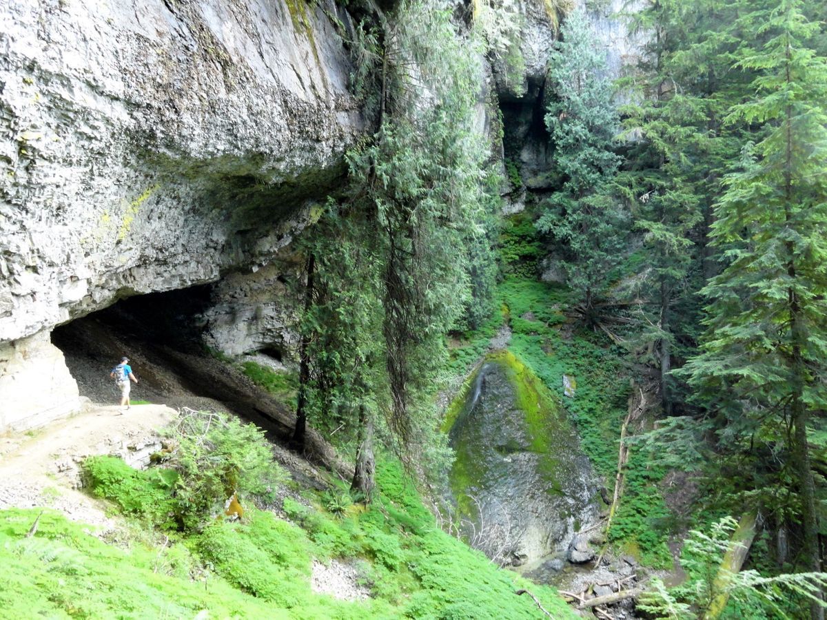
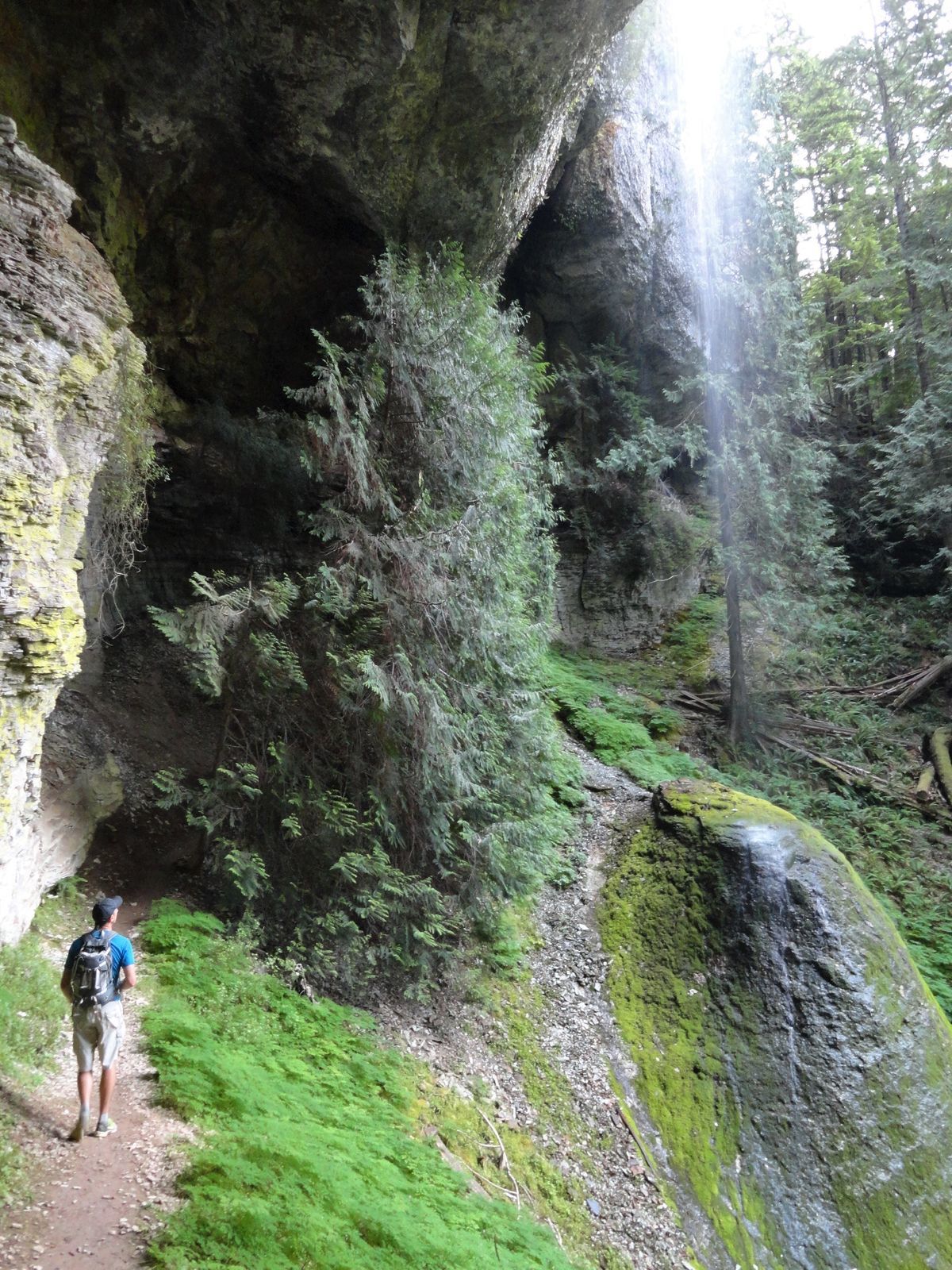
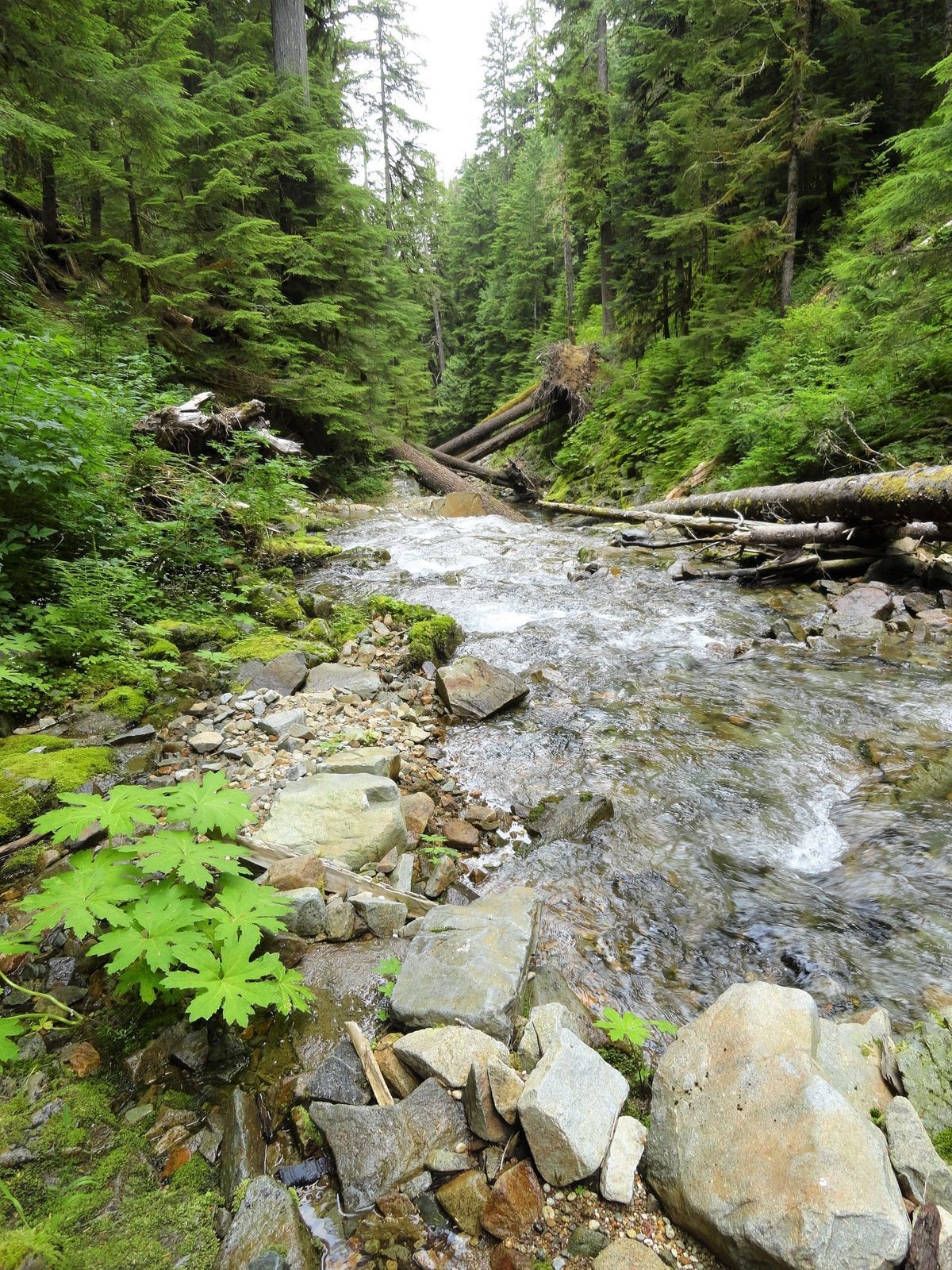
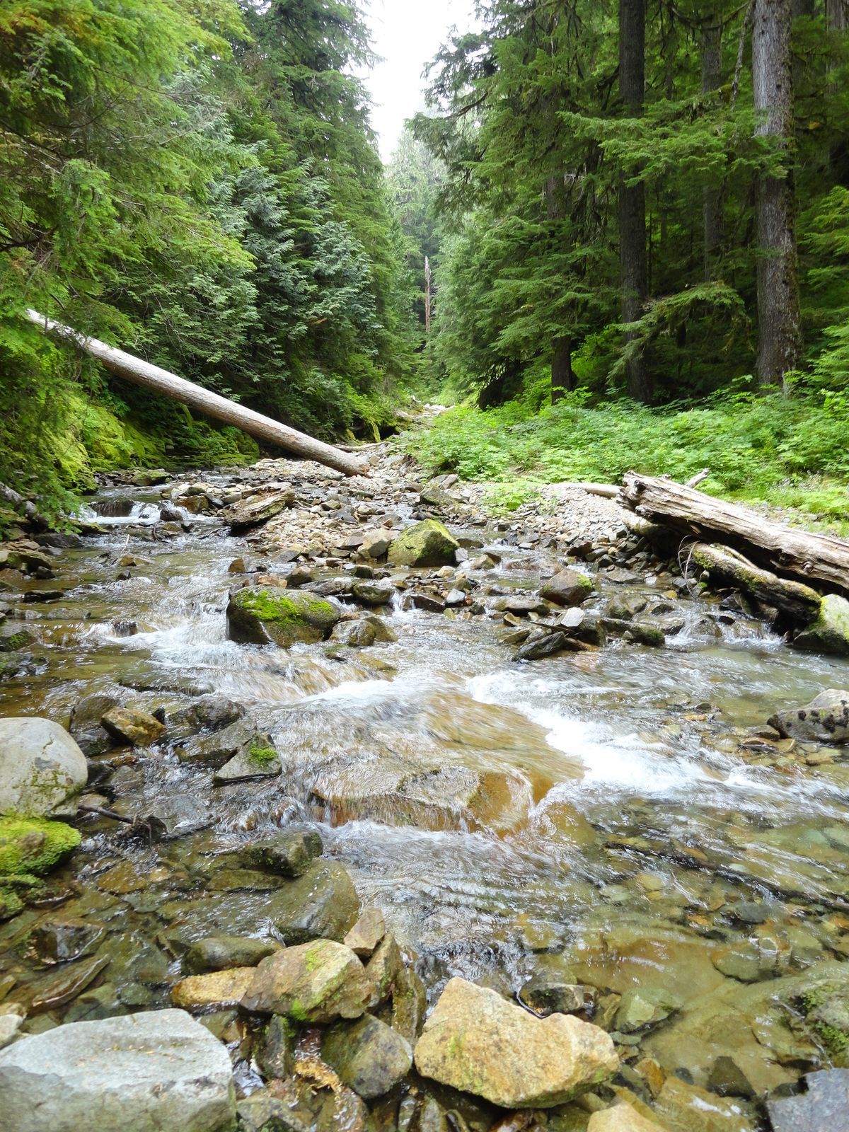
Start your hike by following the Goat Creek Trail. At just over one mile you’ll come to stunning Cathedral Falls. In Columbia River Gorge fashion, the trail ducks behind the falls beneath a massive overhanging ledge. Continue hiking along cascading Goat Creek coming to a junction at 2.2 miles Continue straight here on the Tumwater Trail.
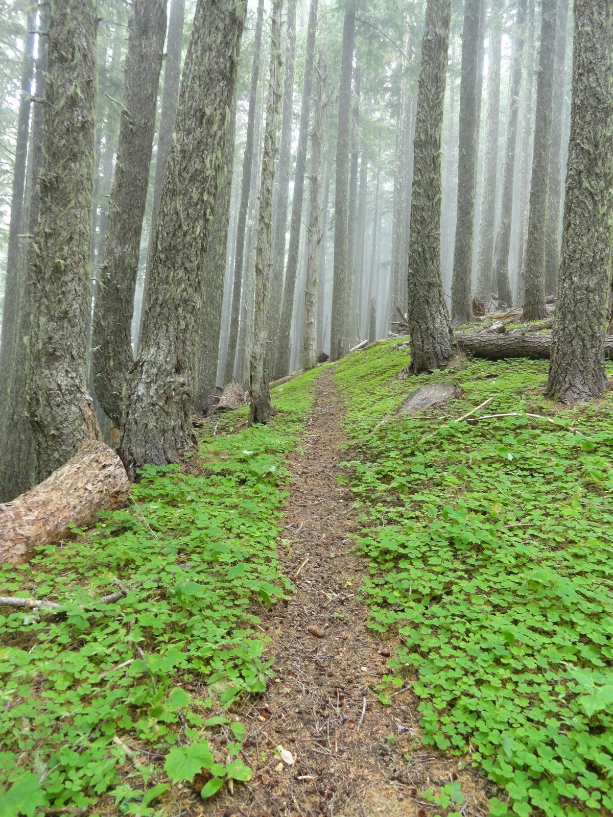
The trail starts by traveling through lush ancient forest along Goat Creek. It passes a couple of pretty waterfalls before at 2.8 miles, turning north to cross. Goat Creek. You’ll need to ford the creek which can be tricky early in the season—but generally, just a rock hop come late summer. Be sure to fill water bottles here, for beyond there might not be any reliable water sources.
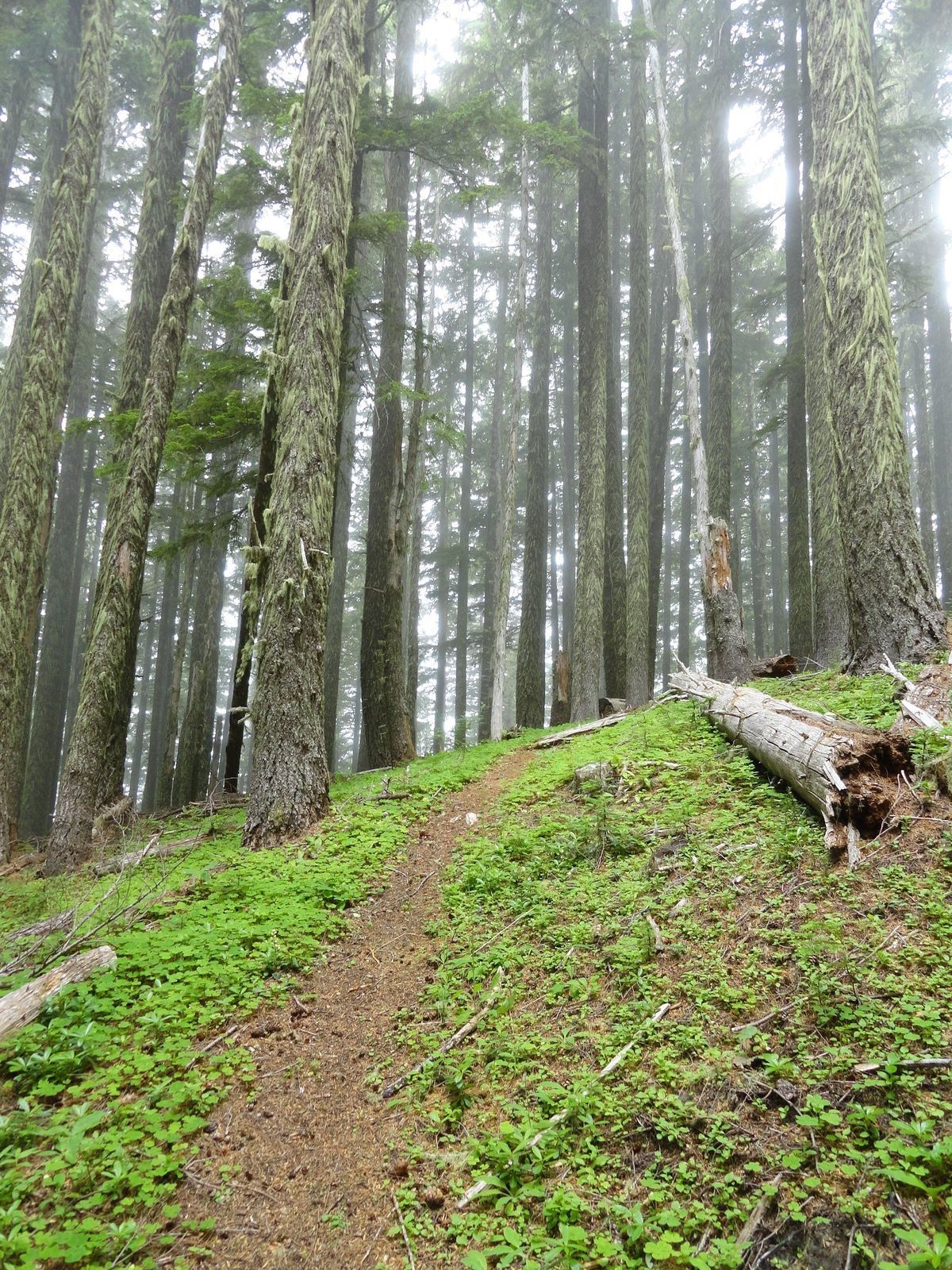
The trail now steadily climbs, traversing steep slopes carpeted in wood sorrels and shrouded in beautiful old-growth forest. After crossing a small creek soon come to a manzanita-lined viewpoint overlooking the Goat Creek valley. Then continue climbing through open uniform forest. Skirt ledges displaying showy sedums and granting window views north across the Cowlitz Valley to Mount Rainier.
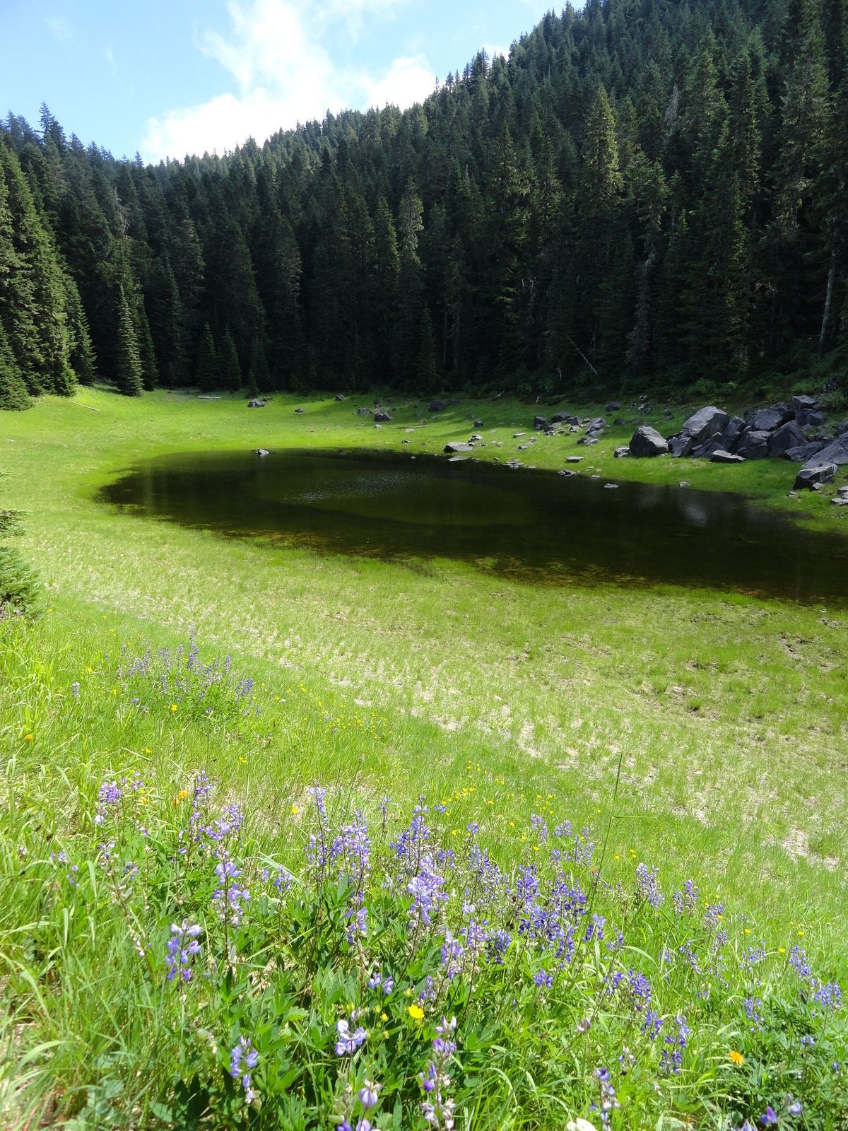
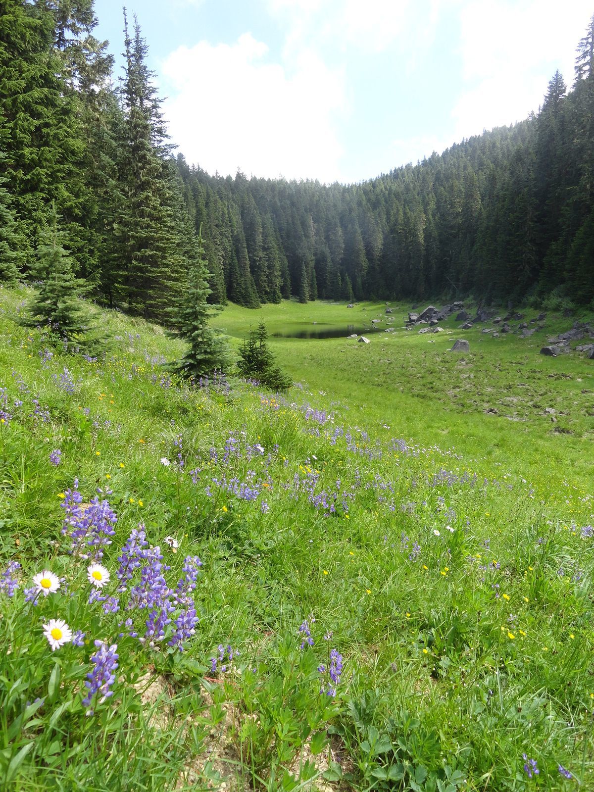
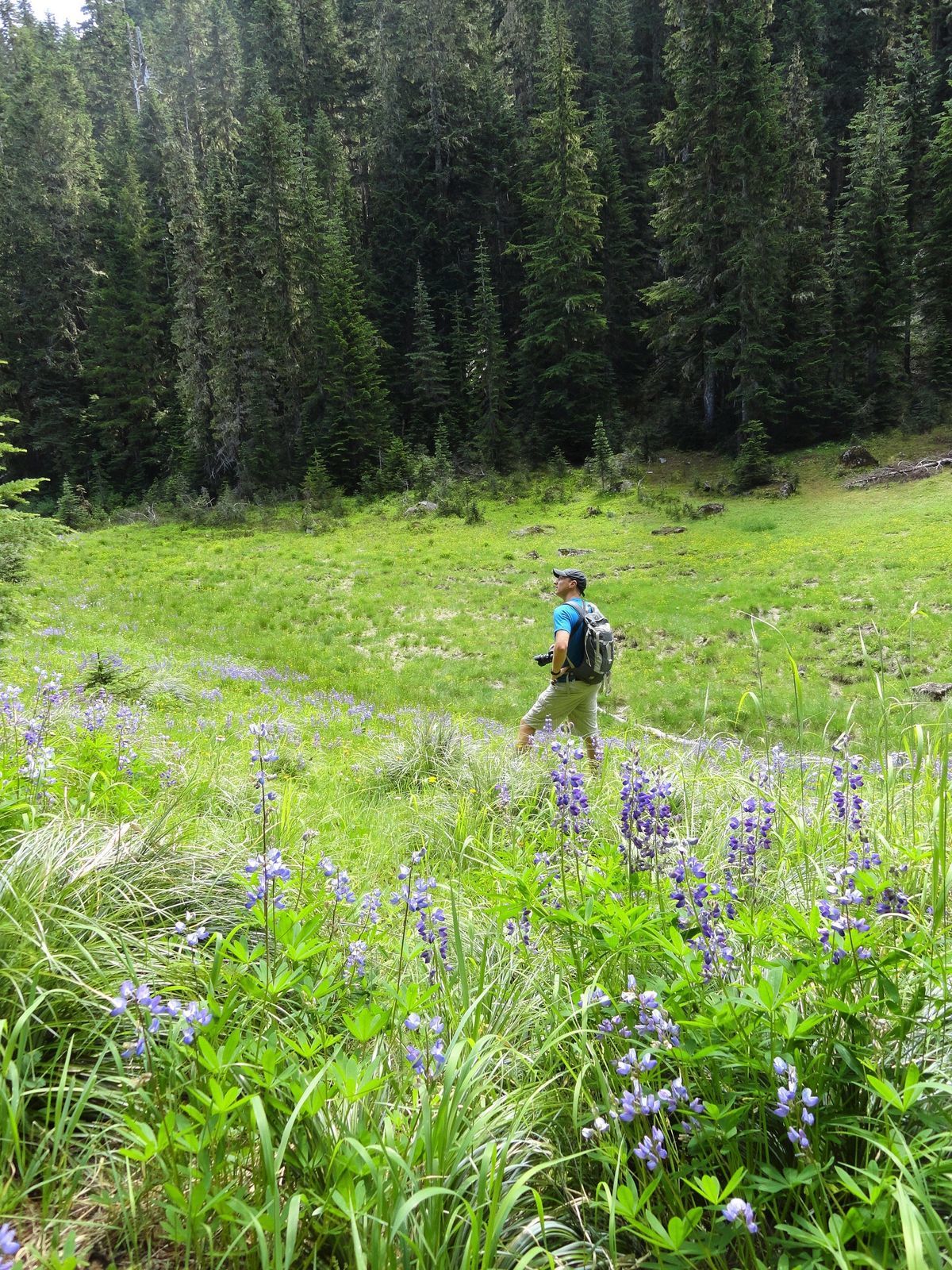
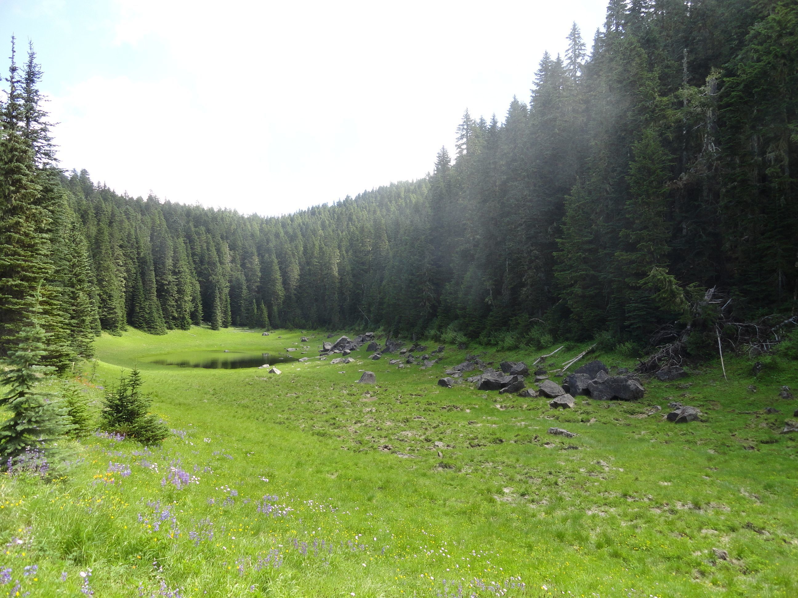
Upon cresting a ridge the trail bends south and the climbing subsides. Now pass some seasonal shallow wetland pools before reaching a meadow bursting with summer wildflowers and often harboring large hoofed mammals. At 6.0 miles reach a small pond surrounded by meadows beneath Tumwater Mountain’s craggy summit. This is a good spot to call it a hike. Take a break, watch for wildlife and savor the solitude.
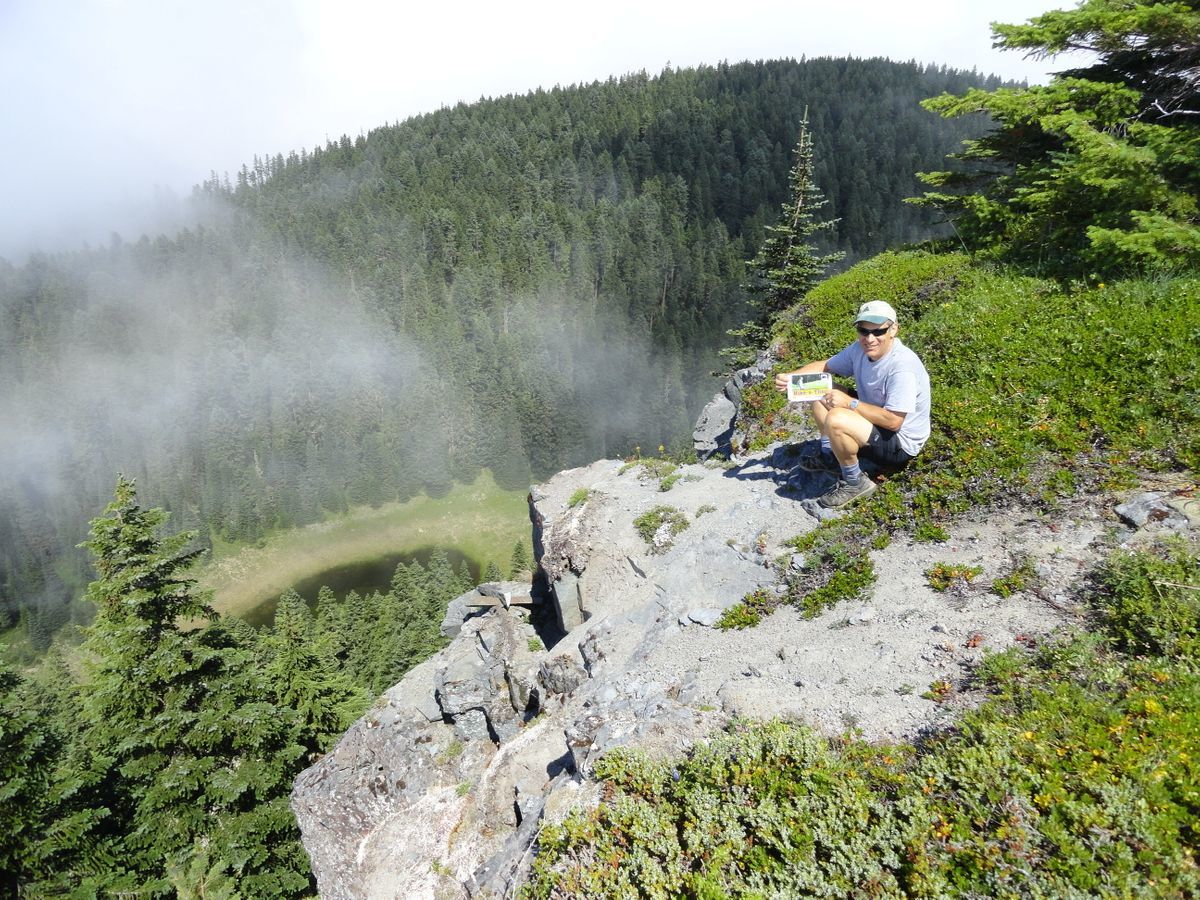
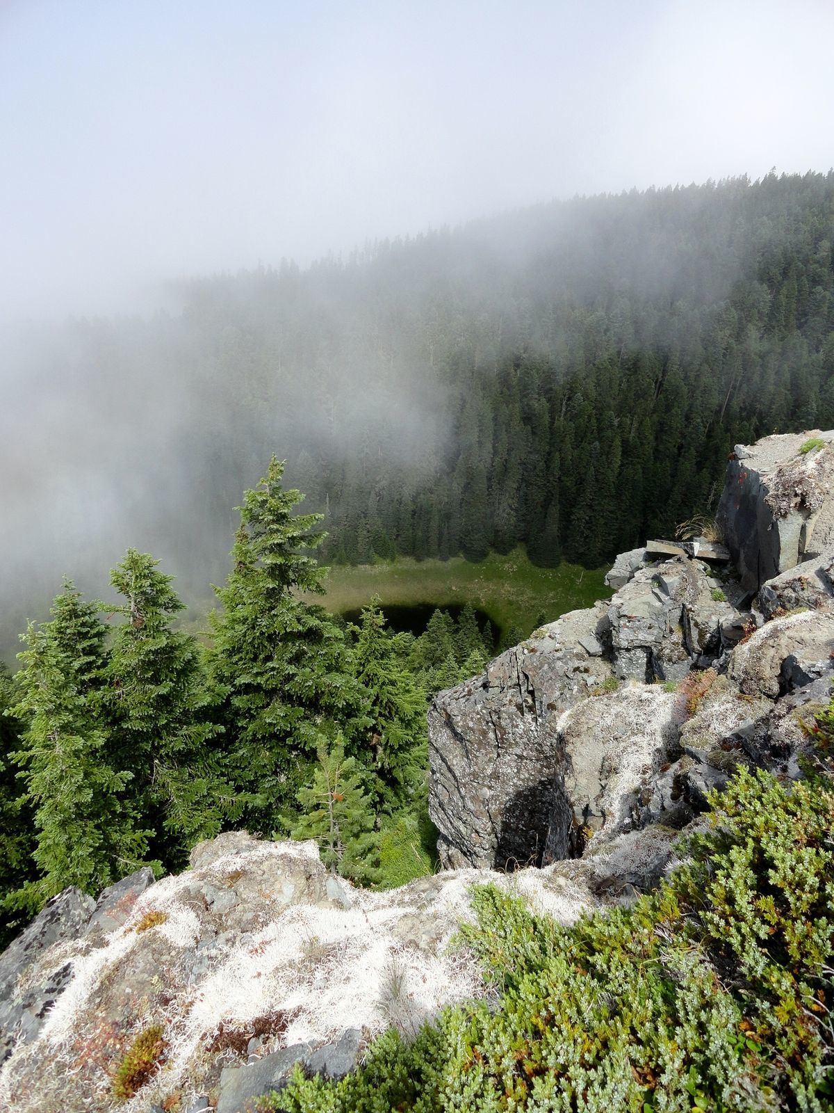
To hike to Tumwater’s high point, continue along the trail. Shortly after reaching a small saddle come to an easy to miss junction at 6.7 miles. Here an abandoned, but still somewhat decipherable spur to Tumwater’s summit veers right. Follow it through blowdowns passing the remains of an old cabin. Tumwater did not house a fire lookout—that honor went to nearby Vanson Peak. I have not been able to find the origins of the cabin here near the summit. The path eventually peters out at .5 mile at some ledges just below the 5245-foot summit.
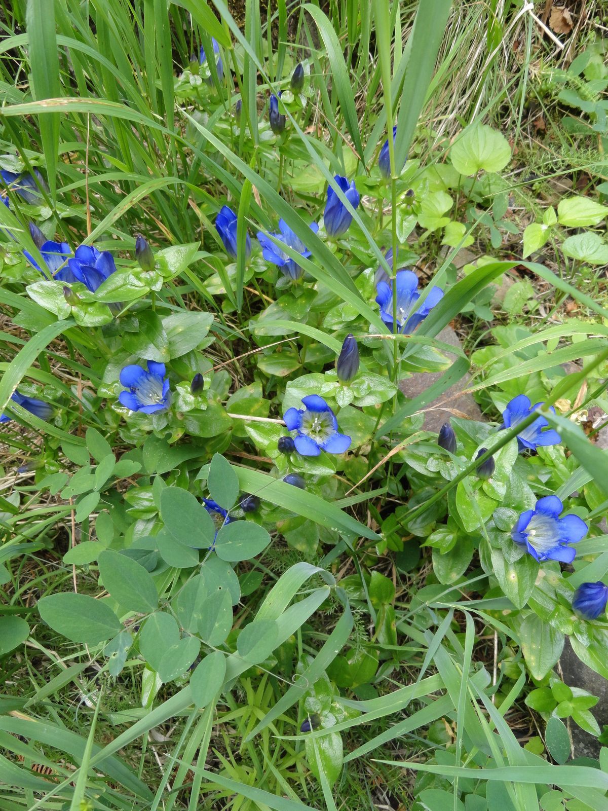
Being careful not to disturb fragile plants, explore the ledges where excellent views can be had of the little lake below, and much of the lonely surrounding forested ridges, peaks and valleys. Out of the blast zone and never logged, the Goat Creek drainage contains some of the largest tracts of old-growth in the monument. Come here in summer and admire some of the flowers growing atop this peak—particularly the cat’s eared lilies growing here at the northern extent of their range.
If you continue along the Tumwater Mountain Trail beyond the spur expect lots of ups and downs over a series of knolls. Solitude is assured.
Trail Resources:
Map: Green Trails Mount St Helens 332S
Guidebook: Day Hiking Mount St. Helens by Craig Romano and Aaron Theisen (Mountaineers Books)
Managing Agency: Mount St Helens National Volcanic Monument
http://www.fs.usda.gov/main/mountsthelens
-Craig Romano, is an award winning author of more than 25 guidebooks with Mountaineers Books. One of the most prolific trails writers in Washington, he has hiked more than 30,000 miles in the state from the Olympics to the Blues. Visit him at CraigRomano.com