We use cookies to improve your website experience. Essential cookies are required for the site to function properly, while analytics cookies help us understand how visitors use our site to make improvements. You can choose to accept all cookies or only the essential ones.


Current Conditions
Mount St. Helens Climbing Route
Safe backcountry travel requires preparation and planning. Current Condition information listed here is collected from on-site observations, multiple state and federal sources, and presented for recreational purposes. This is only one component in a spectrum of critical preparation and should be combined with current weather and avalanche forecasting at all elevations, advanced alpine education, fitness training, proper equipment and attire, and the "Ten Essentials." Mountain conditions are dynamic and can change rapidly without warning. Winter conditions can exist from October to July.
The user acknowledges that it is impossible to predict natural events in every instance accurately, and that the accuracy or reliability of the information provided here is not guaranteed. This report expires 24 hours after the posted time unless noted otherwise.
Last update: July 27, 2026
Marble Mountain Sno-Park: The Sno-Park is clear.
Climber's Bivouac: Travel with care along the road to the Bivouac.
Summit Forecast:
Monday 7/27-Friday 7/31: Expect a few clouds on Tuesday during the day, but otherwise consistently sunny this week with summit highs near 50*F and winds 10-20 mph.
CLIMBING ROUTE INFORMATION
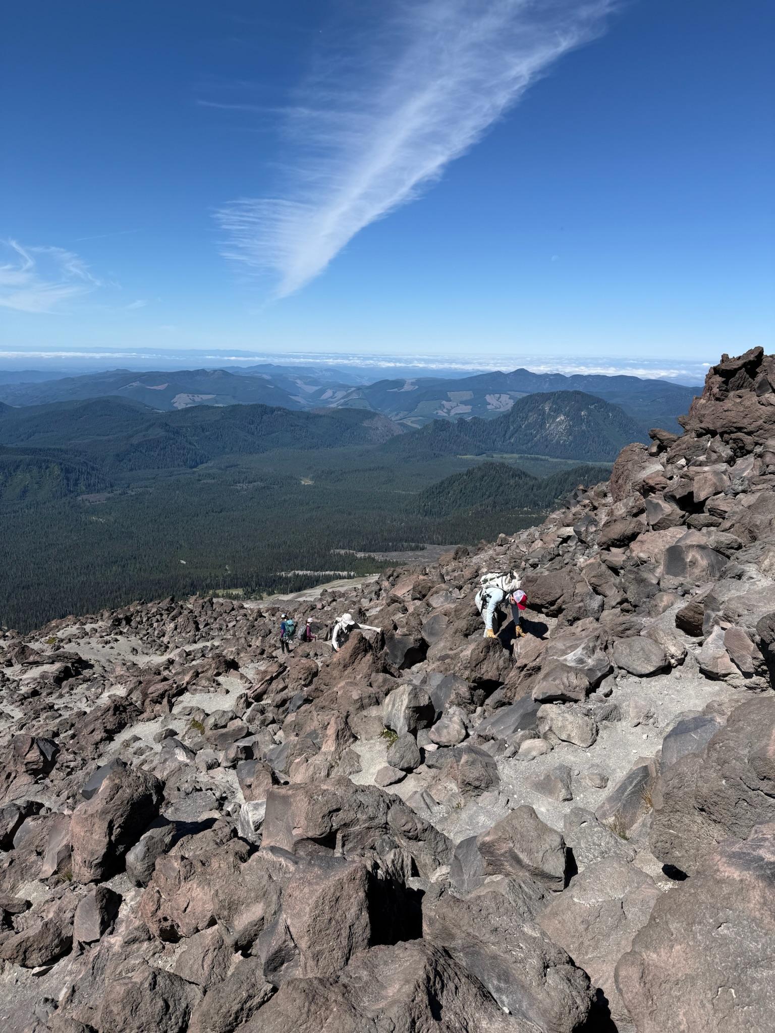
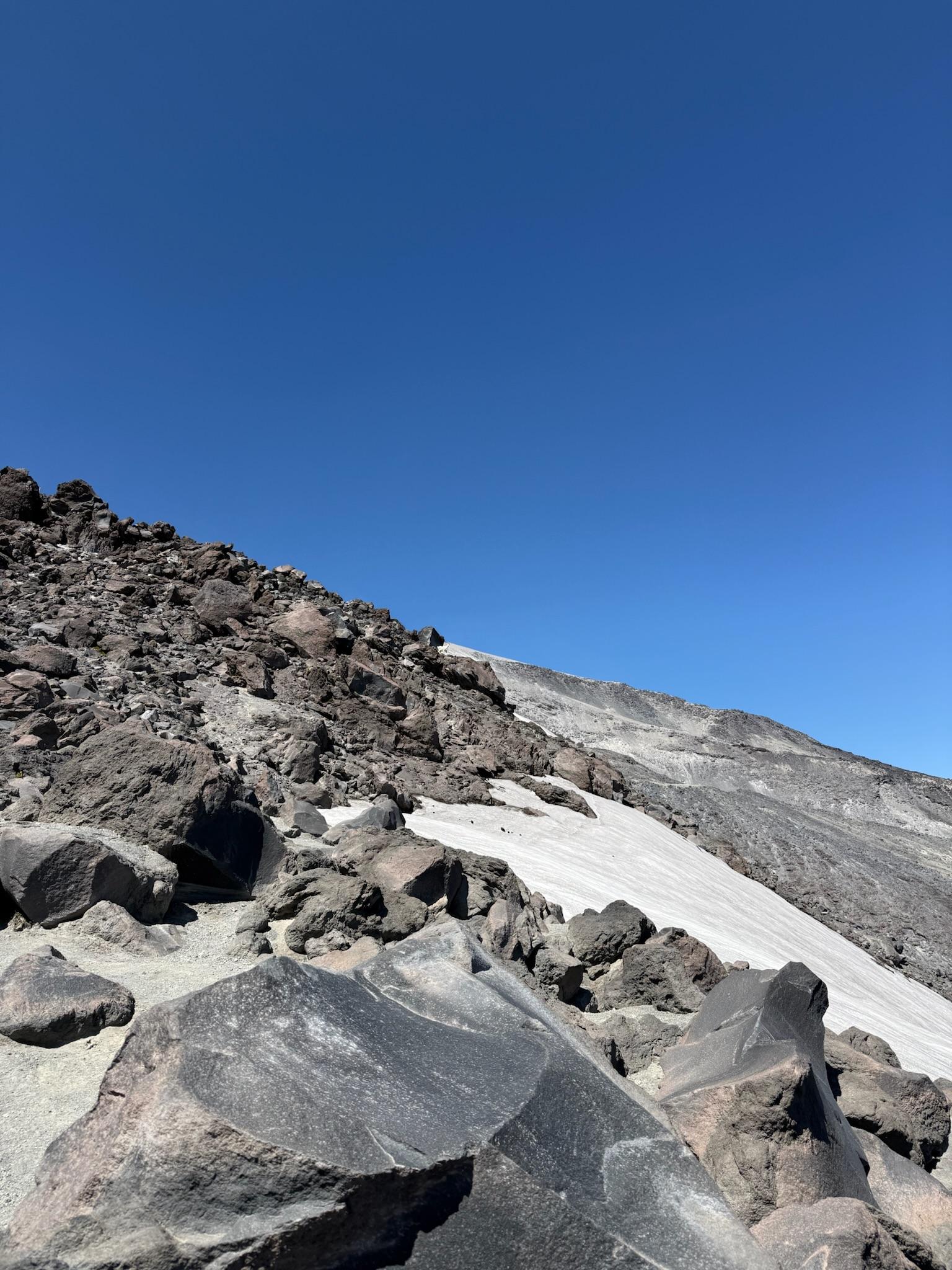
The Monitor Ridge Route out of Climbers Bivouac is now the preferred climbing route to summit Mount St. Helens. The climbing route is snow free, and the traverse West to the true summit is largely clear.
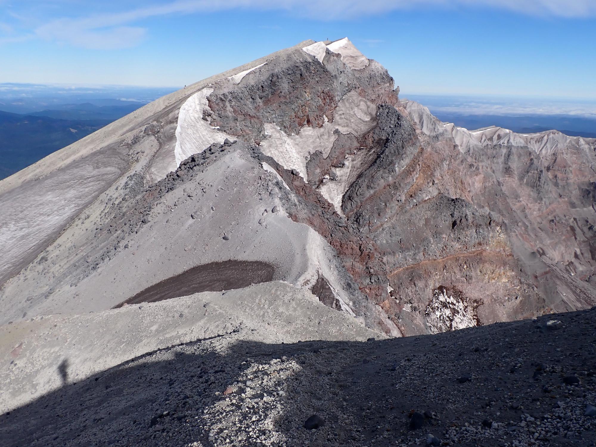
EXERCISE EXTREME CAUTION AT THE RIM. Do not approach the unsupported edge of the rim! Stay back - stay alive!
RECREATION INFORMATION
For information about:
- Climbing Mount St. Helens: Visit our climbing page.
- Winter recreation at Mount St. Helens: Plan your visit here.
- Winter Visitor Center Hours: Check out information about the north side of the volcano.
MSHI GUIDED CLIMBS
Want support during your climb? Check out our guided adventures for more information about summit climbs with the Mount St. Helens Institute. 2026 dates are open! See MSHI's events page for dates and activities.
NORTH SIDE/504 CORRIDOR CURRENT CONDITIONS
Visit MSHI's Volcano Cam to see live video from the Science and Learning Center!
Visit USGS' live feed to see current conditions from Johnston Ridge. You may need to change the feed to "newest first" to see the most recent image.
Check out facebook.com/mshslc/ for recent photos from the Science and Learning Center.


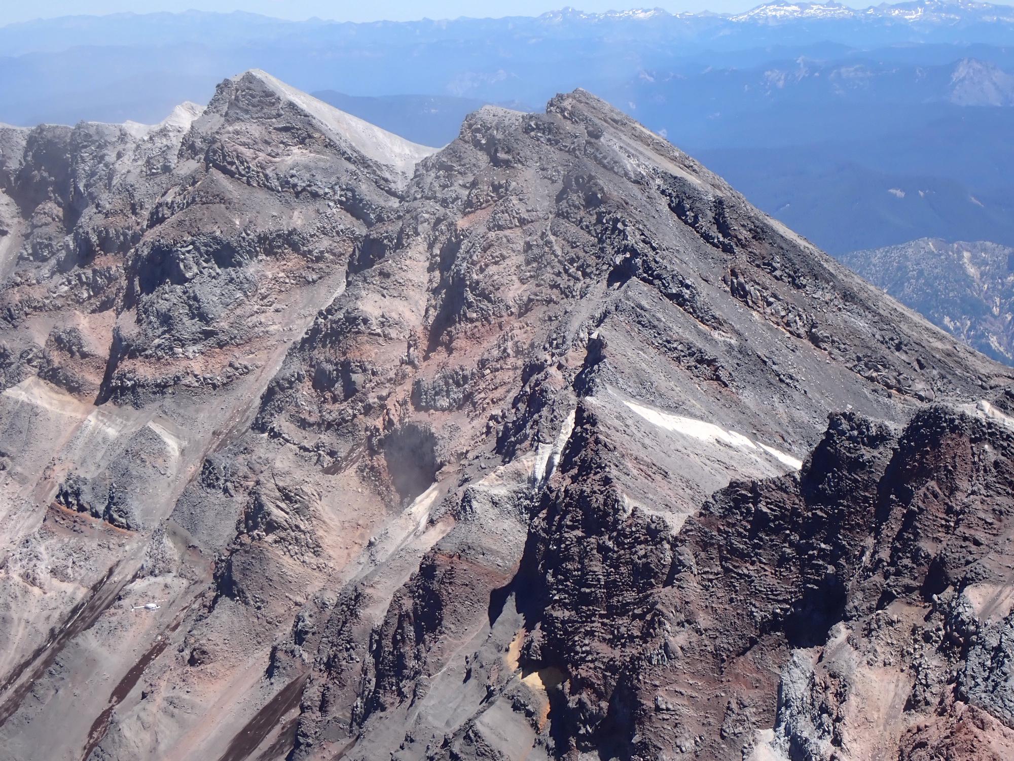
Monitor Ridge Route from the Elbow


Monitor Ridge route @ the Elbow looking down @ Kiwi Camp
ADDITIONAL FORECASTING AND CONDITION GUIDES
U.S. FOREST SERVICE
FIRE
Incident Information System has the most up to date info on all fires (prescribed or wild) around the country, or Northwest Interagency Coordination Center. Visit Washington Smoke Information, Washington's Air Monitoring Network and AirNow for the latest in Air Quality and forecasting.
WEATHER
Weather.gov point forecasts- Marble Mountain SnoPark (2,700ft) and mid-slope (6,200ft). Mountain-Forecast.com provides forecasts at three different elevations: summit 8,328ft, mid-slope 6,500ft and just above the trailhead 3,200ft.
AVALANCHE
Visit the Northwest Weather and Avalanche Center for the most up-to-date avalanche forecast information during winter months.
SNOWPACK
Visit these SNOTEL sites for recent snow pack readings on the south side of Mount St. Helens- June Lake (3,400ft) and Swift Creek (4,400ft).
Cornice
CORNICE WARNING: The rim cornice is present and dangerous. The cornice does collapse and people have fallen into the crater. STAY BACK - STAY ALIVE.


Avalanche Conditions
AVALANCHE CONDITIONS:
The '25-'26 forecasting season has concluded. Check the Northwest Avalanche Center website for more information.
Roads
South side: All roads and trailheads are open.
- FR 83 (Ape Canyon/Lava Canyon): OPEN
- FR 830 (Climber's Bivouac): OPEN
West side: Highway 504 is clear to the Science and Learning Center and down to the Hummocks trailhead. Highway 504 remains closed at the Hummocks trailhead. State crews are working on repairing the bridge to Johnston Ridge Observatory. For more information, see WSDOT.
East side: Windy Ridge and other east side attractions are OPEN as of June 15. FR99 to Windy Ridge is OPEN. FR 25 is OPEN.
Lewis River Corridor: FR 90 is OPEN. Parking in the Lewis River waterfall corridor requires a special parking permit available at recreation.gov.
BE PREPARED
BE PREPARED: Know the types and uses of traction devices, ice ax, and self-arrest techniques. Know the forecast at all elevations before your climb, have cold/wet weather layers and redundant navigational aides (map, compass and GPS) for low-visibility conditions. Have GPS basemaps and tracks in your navigation device before you go and look for pole cairns that mark the route above treeline.
PERMITTING: Washington Sno-Park Permit required as of Dec 1. Refer to the recreation and permitting site for current permit dates, prices and limitations. Information about Washington State sno-park passes can be found here.
CLIMBING ROUTE: Refer to the recreation and permitting site for current permit dates, prices and limitations. Climbing information from the Mount St. Helens Institute is found here.
LEAVE NO TRACE: Climbers are required to utilize blue bags to pack out all human or pet waste, including toilet paper.
CAMPING: There is dispersed camping and pit toilets available at Climber's Bivouac and Marble Mountain, but no running water, and bathroom services may be limited so please bring your own toilet paper, soap, water, or hand sanitizer. Please plan accordingly.
When camping at trailheads is permitted, please ensure that your vehicle and camp only take up one parking spot.
MOUNT ST. HELENS NATIONAL VOLCANIC MONUMENT GENERAL CONDITIONS
Plan your visit to Mount St. Helens using our information page at www.mshinstitute.org/visit.
NORTH SIDE (504 CORRIDOR): 504 access open through Coldwater Lake and Hummocks Trail. South Coldwater trailhead open to bikes and foot traffic. Science and Learning Center open for visitors 7 days a week. Johnston Ridge Observatory is closed.
EAST SIDE (WINDY RIDGE): The 99 road to access Windy Ridge is open for the season. The Truman Trail, 99 Extension Road, and Harry's Ridge Trail are closed M-F (open Saturday and Sunday) due to Spirit Lake Outflow Tunnel construction; see USFS alert for details.
SOUTH SIDE: Ape Cave is open for timed ticket entry May 22, 2026. All south side roads and trailheads are open for the season. Lewis River waterfall corridor parking requires an additional day-specific parking pass, available at recreation.gov.
ALL AREAS: Fires are permitted in most areas. Use precautions to prevent wildfires. Fires are not permitted in zone 3 of the Monument, including recreational areas along the 504 corridor, Windy Ridge, the pumice plain, and the Mount Margaret Wilderness. Propane cooking stoves, lanterns, and heaters with off switches permitted in all areas.

