SEARCH
Roundtrip: 7.6 miles
Difficulty: moderate
Elevation Gain: 1650 feet
High Point: 4,750 feet
Best Season: summer through fall
Trail Notes: No trail pass required. Practice leave no trace principles. Trail is open to mountain bikes.
Trail Highlights: old-growth forest, exceptional summer wildflowers, dog-friendly, exceptional views, backpacking opportunity,
Directions to Trailhead: From Woodland follow SR 503 east for 29 miles to Cougar. Then continue east on SR 503 (which becomes FR 90) for 7.0 miles turning left onto FR 83. Continue 3.0 miles bearing left onto FR 81. Then drive 2.9 miles to the trailhead at Redrock Pass. Alternatively, this trailhead can be reached from FR 81 via Merrill Lake.
Long before Mount St Helens blew its top in 1980, Butte Camp was a popular overnight spot for climbers intent on summiting the then 9,677-foot volcano. Determined peak baggers would leave camp and continue ascending through thinning forest to the alpine zone where they would follow a route over rock, snow and ice to the summit. While the terrain has radically changed since those early days and the vast majority of St Helens climbers now ascend via either Monitor Ridge or Swift Creek, the Butte Camp route is still a viable and official route. If you’re intent on reaching St Helens’ crater rim via this route you’ll need to secure a climbing permit. And you’ll need to be well versed using a map and GPS following the route. Most hikers however will be pretty content just following the Butte Camp Trail to its termination at the Loowit Trail.
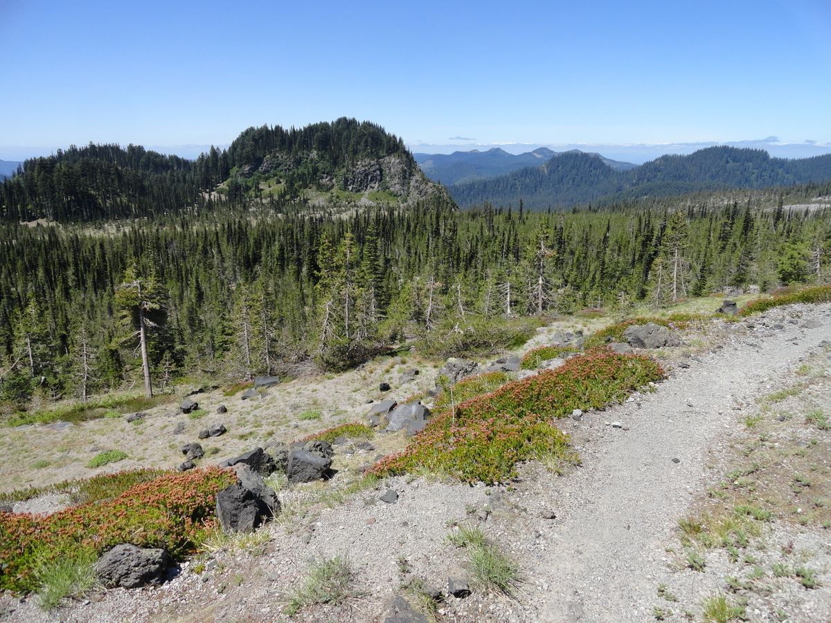
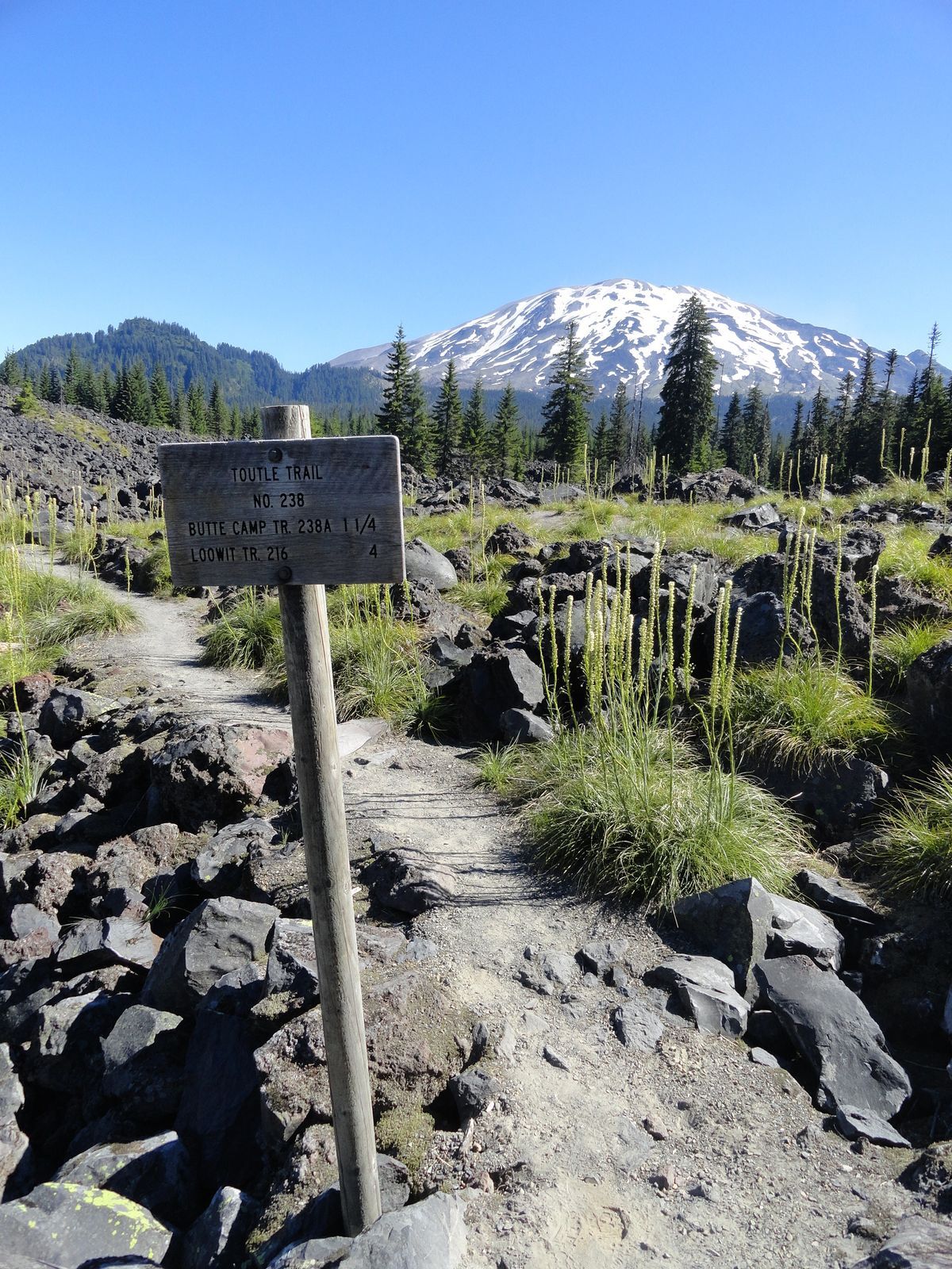
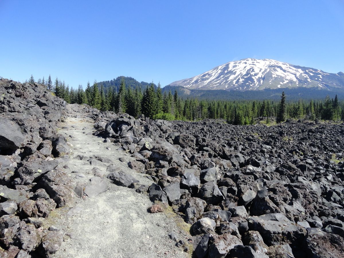
This is a great day hike, not too crowded, not too long and not too steep. It’ll take you across varied terrain including old lava flows, old-growth forest, and pumiced meadows that burst with wildflowers by early summer. Access to the Butte Camp is via the Toutle Trail from Red Rock Pass. Start your hike from an elevation of more than 3,000 feet and immediately come to an old lava flow that erupts with bear grass and a stunning view of Mount St Helens. The well-maintained trail makes traversing the 2,000-year old andesite lava flow easy. As you hike across the rocky landscape notice the forested knob to the left of the volcano. That’s Butte Camp Dome, a double nearly identical in elevation 4700-plus foot dacite lava plug.
The trail next enters an open forest of fir and pine and reaches the Kalama Ski Trail. Continue straight and after hiking 1.1 miles and gaining only 300 feet of elevation come to a junction with the Butte Camp Trail. The Toutle Trail continues northwest heading to Blue Lake and then the Loowit Trail at the Toutle River. You want to head right and begin to more steadily ascend. The trail winds through lodgepole pine groves and huckleberry patches (calling for a return visit later in the summer) and edges up against another old lava flow.
At 2.4 miles reach Butte Camp situated on a flat alongside a good creek beneath Butte Camp Dome. You’ll find decent campsites here and probably a few campers during summer weekends. The camp was far busier when this route was used to ascend St Helens. But it also makes for a good spot for Loowit Trail backpackers too due to shortage of good camps and water sources along that trail.
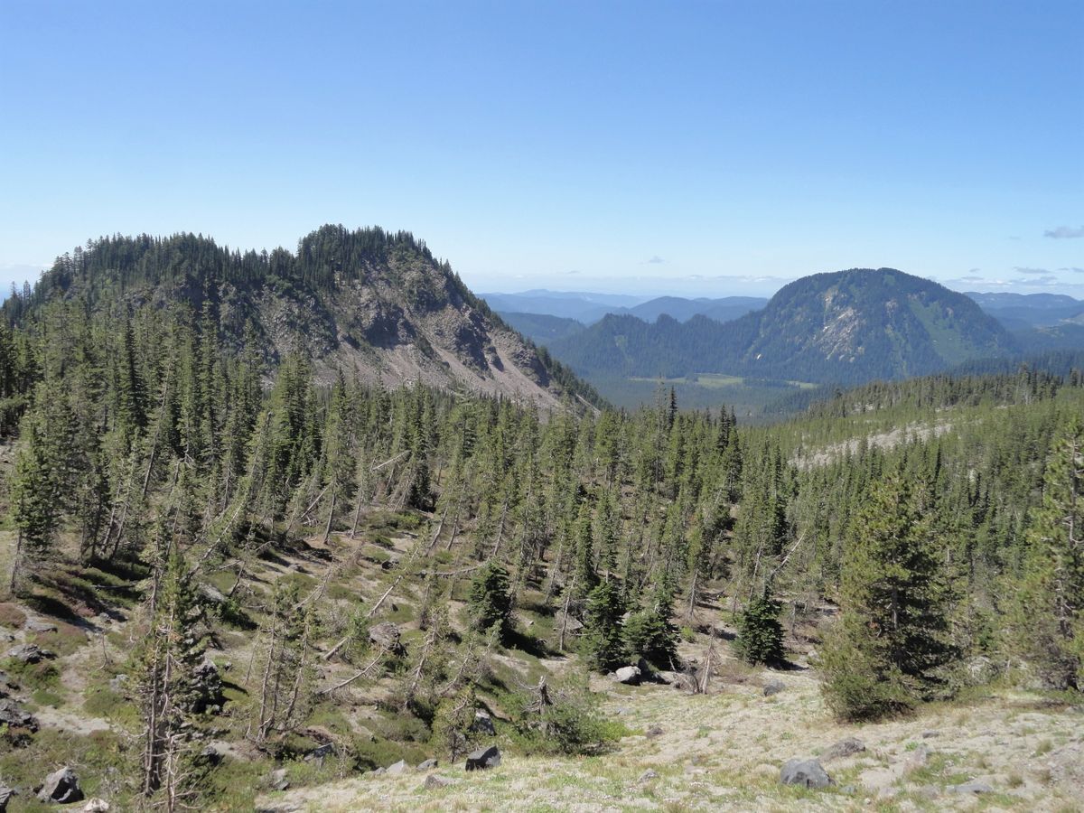
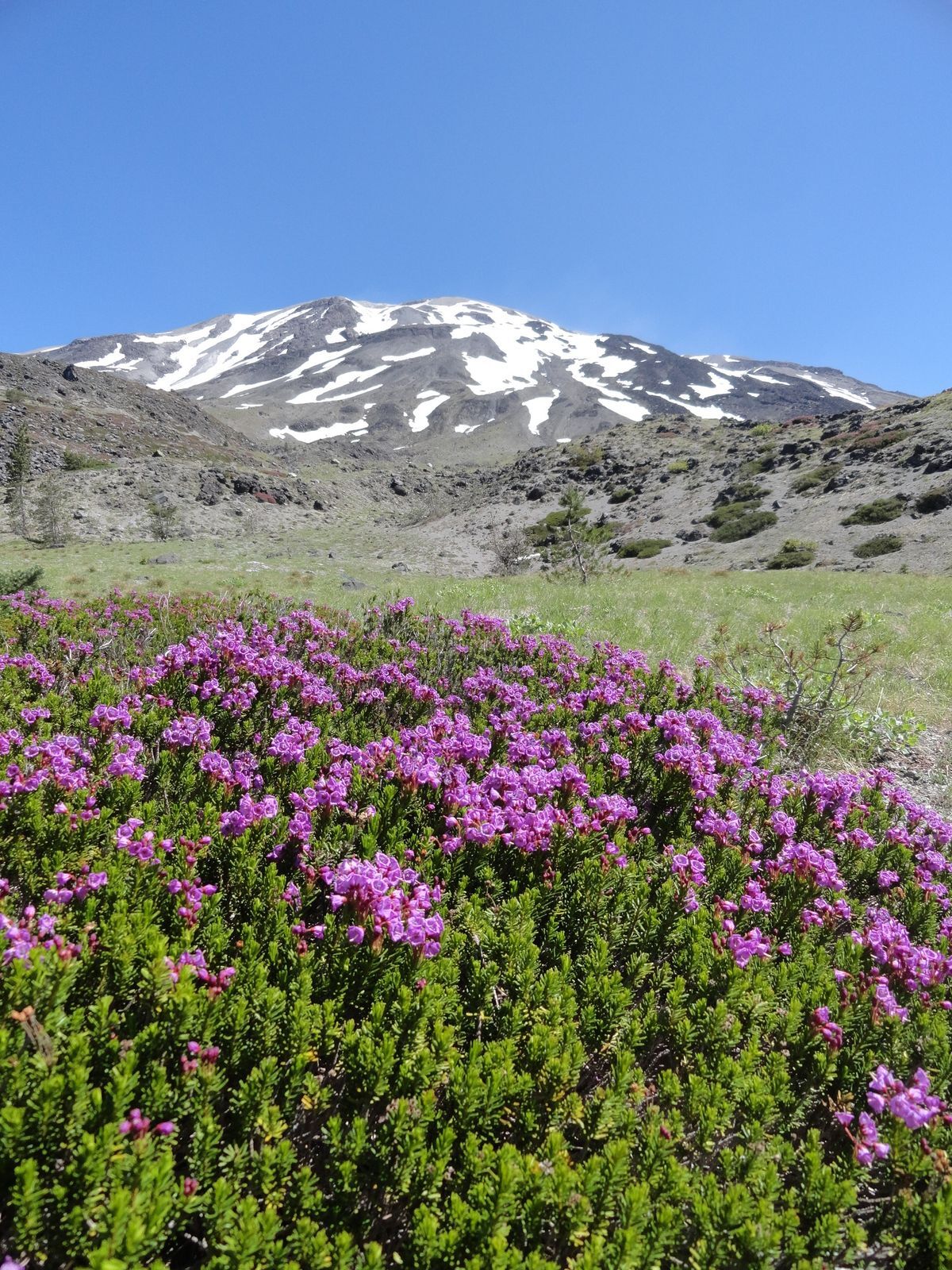
Beyond the camp the trail continues ascending. Switchback through a gorgeous old growth grove of noble firs. The way then eventually breaks out of the forest and begins traversing open slopes. Take your time and savor the sweeping views south to Mount Hood, the Indian Heaven Wilderness country, the Trapper Creek Wilderness peaks, and Silver Star Mountain. And enjoy the flowers too as bountiful blossoms paint these south facing slopes in a wide array of colors throughout the summer.
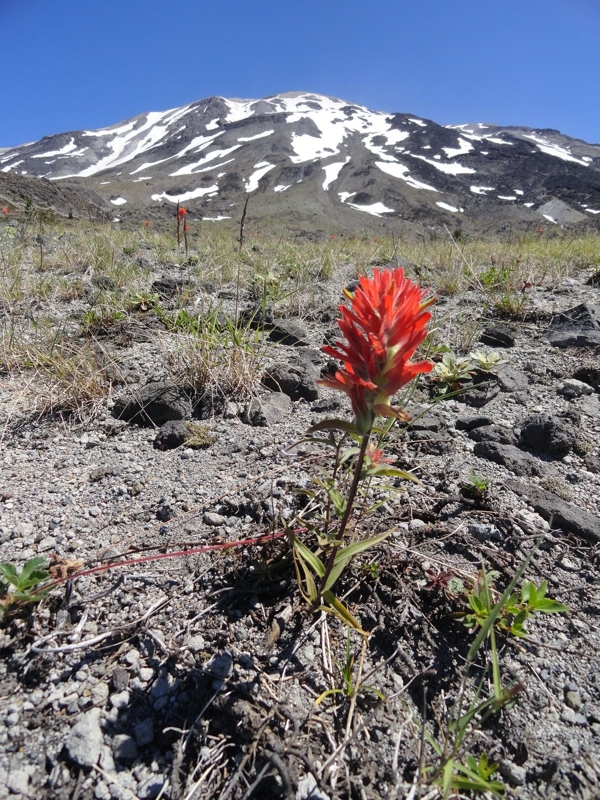
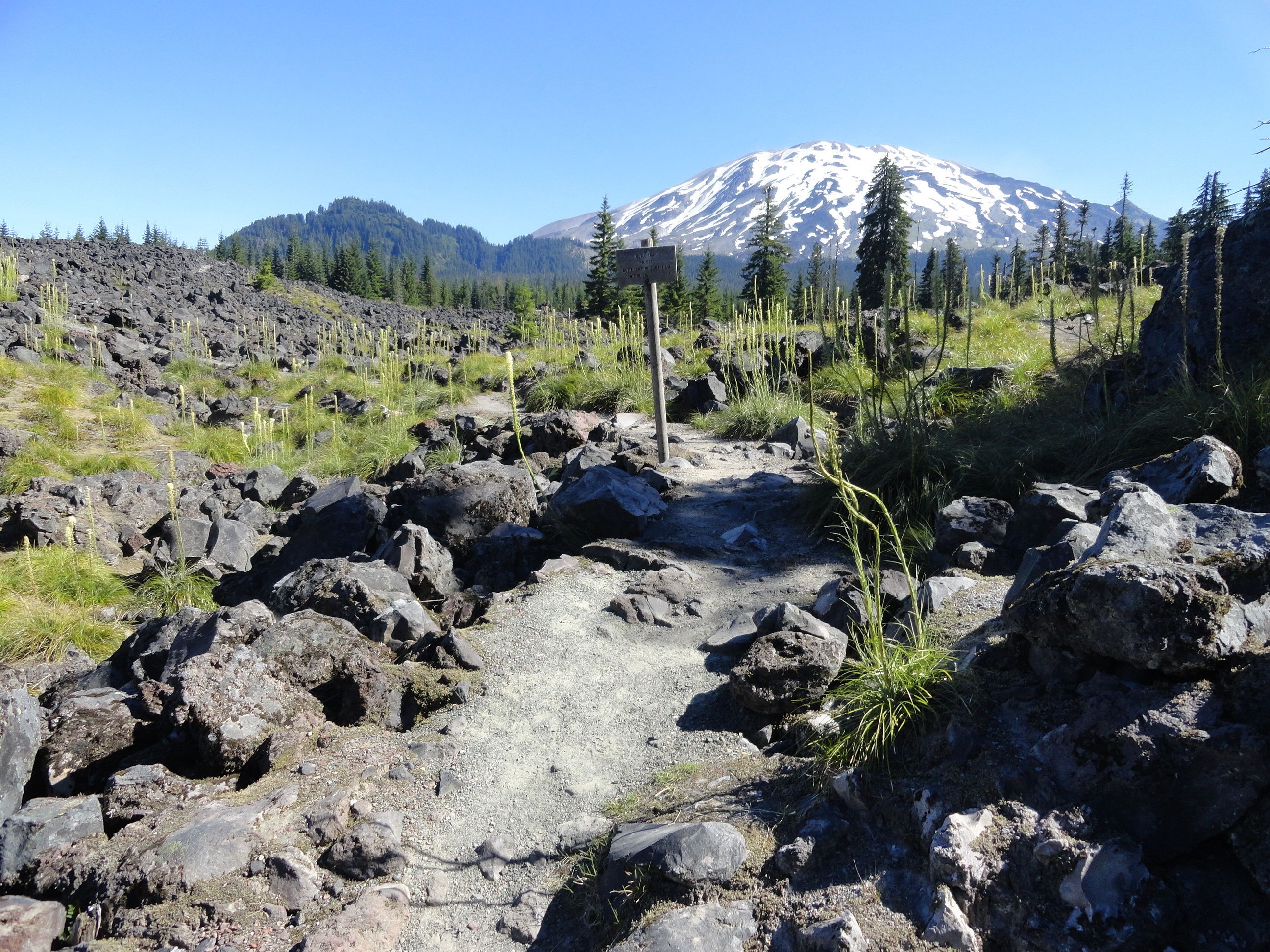
Continue hiking across pumice, rock and ledge coming to a broad bench punctuated with pines before hiking up an old lava flow. Mount St Helens with its lingering snowfields and glacier remnants looms above creating a gorgeous imposing backdrop. At 3.8 miles reach a junction with the Loowit Trail at an elevation of 4750 feet. The climbing route continues a short distance to the right initially following an old lava flow. It is more arduous than the Monitor Ridge but does guarantee a bit of solitude.
But no need to climb to enjoy more views and wildflowers. From the trail junction feel free to wander left or right on the Loowit Trail as far as you’d like across pumiced meadows rife with flowers and views.
Trail Resources:
Map: Green Trails Mount St Helens 332S
Guidebook: Day Hiking Mount St. Helens by Craig Romano and Aaron Theisen (Mountaineers Books)
Managing Agency: Mount St Helens National Volcanic Monument
http://www.fs.usda.gov/main/mountsthelens
Craig Romano is an award-winning author of more than 25 guidebooks with Mountaineers Books. One of the most prolific trails writers in Washington, he has hiked more than 30,000 miles in the state from the Olympics to the Blues. Visit him at CraigRomano.com