SEARCH
Roundtrip: 2.5 mile loop
Difficulty: easy
Elevation Gain: 250 feet
High Point: 2,550 feet
Best Season: late spring through fall
Trail Notes: dogs prohibited; off trail travel prohibited, practice leave no trace principles
Trail Highlights: hummocks, wetlands, regenerating forest, spring and summer wildflowers, rich wildlife habitat, views of North Fork Toutle River and the 1980 blast zone
Directions to Trailhead: From Castle Rock (Exit 49 on I-5) follow SR 504 east for 45 miles turning right into the large parking area and trailhead for the Hummocks.
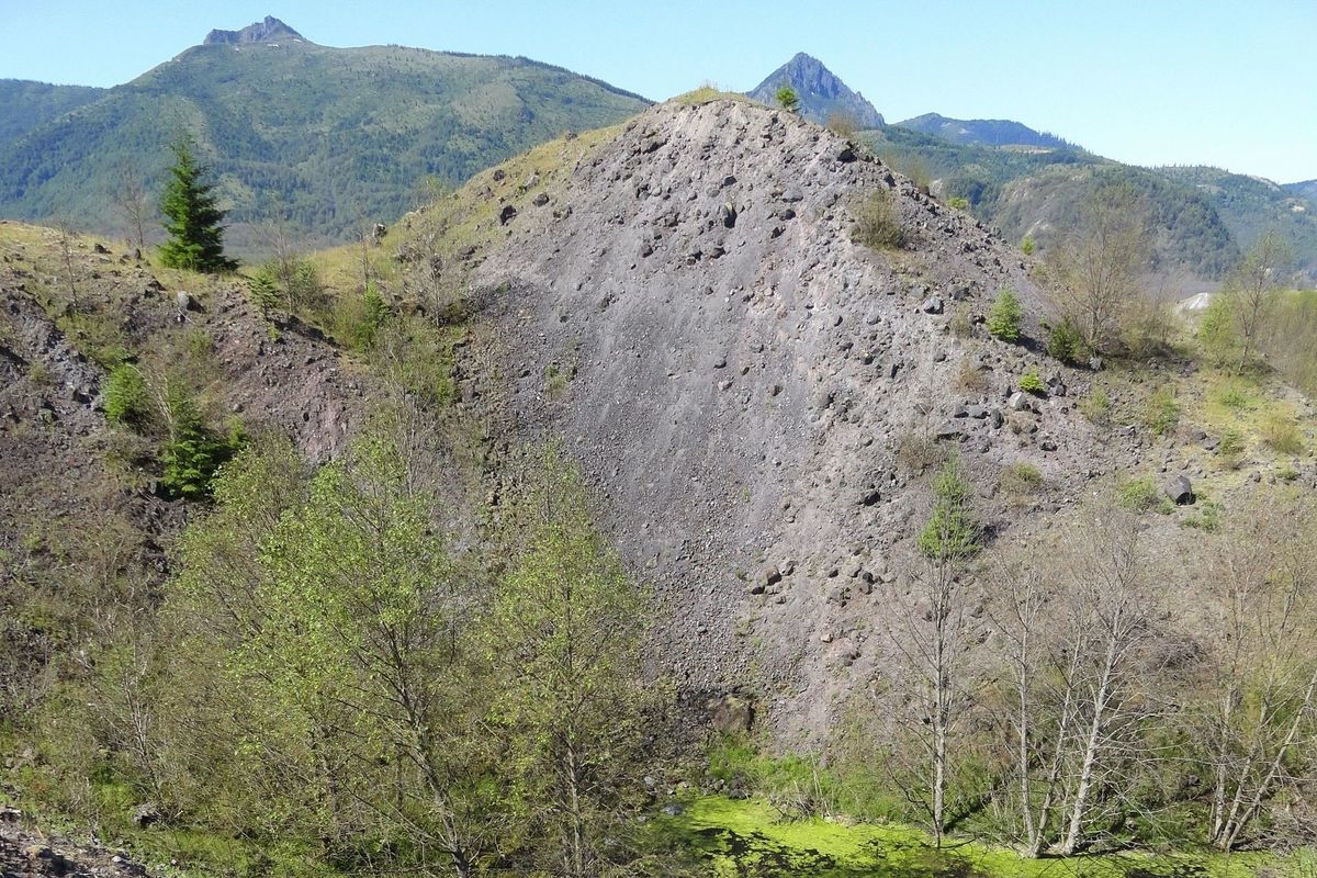
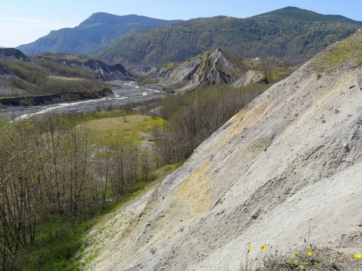
Before the 1980 eruption of Mount St Helens, many geologists from around the world believed that the copious mounds found around many volcanoes were the result of mudflows or glaciers. Mount St Helens’ massive debris avalanche proved otherwise. The volcano collapsed into three separate blocks producing a debris avalanche that traveled 14 miles down the North Fork Toutle River Valley. What was left in the aftermath was a jumbled landscape of rock deposits from the core of the volcano. The deposits buried the valley with debris more than 600 feet deep in places and buried the river and several of its tributaries. You can walk across a portion of this fascinating altered landscape on the Hummocks Trail.
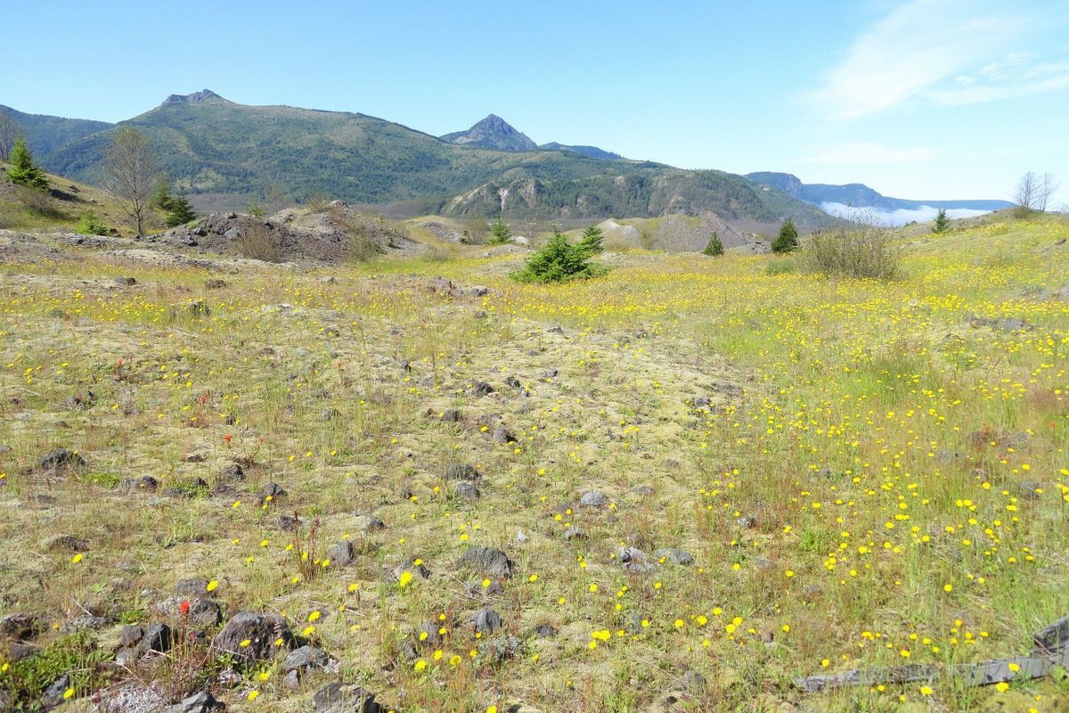
Like the rest of the Mount St Helens National Volcanic Monument, the hummocks landscape is in constant flux. Change is a constant at St Helens and it has come rapidly. If you were to walk this trail when it was developed a few years after the eruption you would have been greeted with harsh gray mounds of rocky debris nearly devoid of vegetation. But the agents of erosion—wind, and water—along with the regenerative powers of nature have quickly smoothed out many of the harsher hummocks, created large pockets of wetlands, and given birth to flowered flats and groves of colonizing forest.
From the trailhead kiosk begin this loop hike clockwise. Immediately enter a forest of tall alders punctuated with firs and carpeted with grasses. A far cry from what once resembled a badlands. The trail comes to the first of several interpretive signs that will explain the formation of the hummocks and its fascinating ecology. The wide and well-groomed trail goes up and down the lumpy landscape skirting several ponds and marshes. Ice blocks formed pits in the hummocks and wind and rain carved folds and caused ridges to collapse creating depressions. These pits and depressions fill with melting snow and rainfall creating life-sustaining wetlands. Some of the pools are ephemeral forcing their denizens to reproduce rapidly and move on. Bugs, birds, and amphibians are prolific in the hummock and contribute—especially in early summer to an ensemble of soothing outdoor melodies.
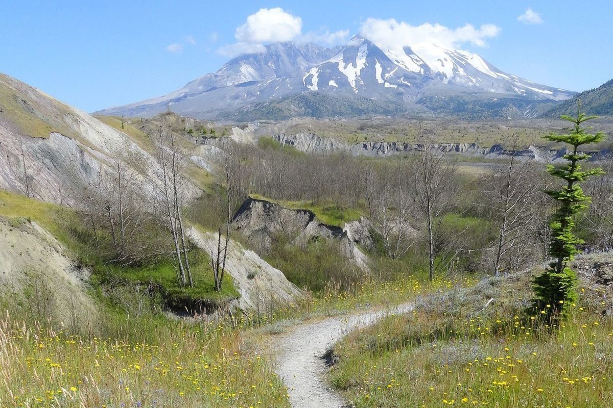

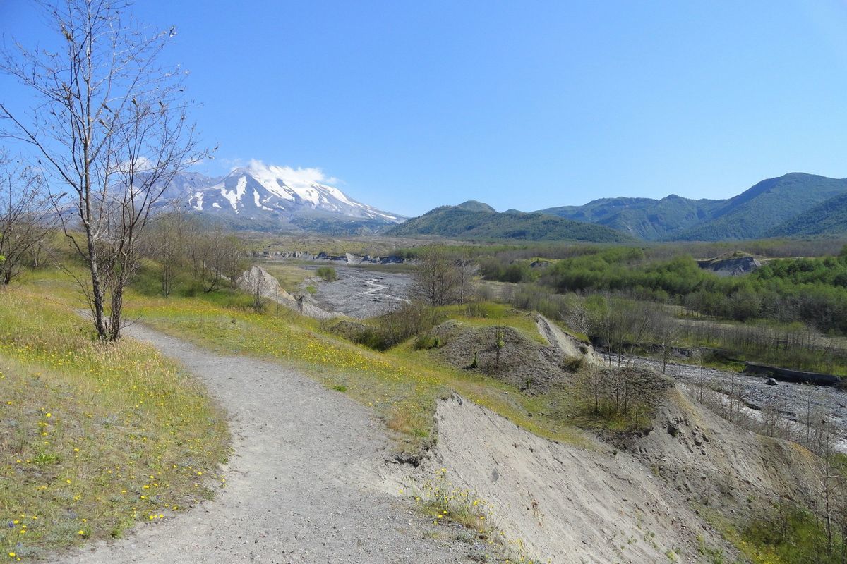
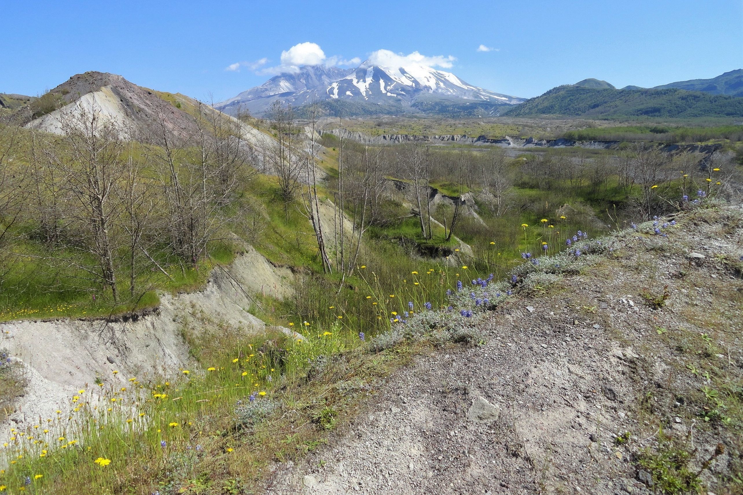
As you wind through this fascinating land of towering colorful gravel mounds and lush wildlife-rich pocket ponds try to imagine how this land before you changed so radically. The hummocks vary in shape from circular to elliptical. Some are quite small while others expand for more than a half mile. The trail soon reaches a junction with the Boundary Trail in a grassy and flowery plain beneath the watchful eye of St Helens. Enjoy good views here across a large swath of the hummocks out to the volcano. The Hummocks Trail continues right to a large wetland pool flanked with large alders.
The trail then travels along a bluff on the North Fork of the Toutle River. The river was initially buried after the eruption. Two years later rain and snowmelt and mudflows from another eruption helped carve new river channels in the valley. The river’s channel has substantially deepened and widened and the river continues to eat away at the deposits. From the bluff take in excellent views of the channeled river and of Mount St. Helens.
Continue hiking and after crossing a flower-lined creek come to a junction. The short spur to the left leads to a good river bluff-top view out to Elk Rock and down the valley. It’s also a good spot for sighing swallows that have nested along the river’s banks. The loop continues right following a small creek uphill. It makes a couple of bridged crossings of it and comes to a big marshy area. Bird life is prolific and beavers have periodically taken residence here. Look for signs of their presence. The trail then continues through a grassy flat and passes yet another wetland. It then makes a slight ascent through a forest of alders before returning to the trailhead.
Trail Resources:
Map: Green Trails Mount St Helens 332S
Guidebook: Day Hiking Mount St. Helens by Craig Romano and Aaron Theisen (Mountaineers Books)
Managing Agency: Mount St Helens National Volcanic Monument
http://www.fs.usda.gov/main/mountsthelens
Craig Romano is an award-winning author of more than 25 guidebooks with Mountaineers Books. One of the most prolific trails writers in Washington, he has hiked more than 30,000 miles in the state from the Olympics to the Blues. Visit him at CraigRomano.com