SEARCH
Roundtrip: 9.9 miles
Difficulty: moderate
Elevation Gain: 1000 feet
High Point: 3475 feet
Best Season: December to April
Trail Notes: Sno-Park Pass required
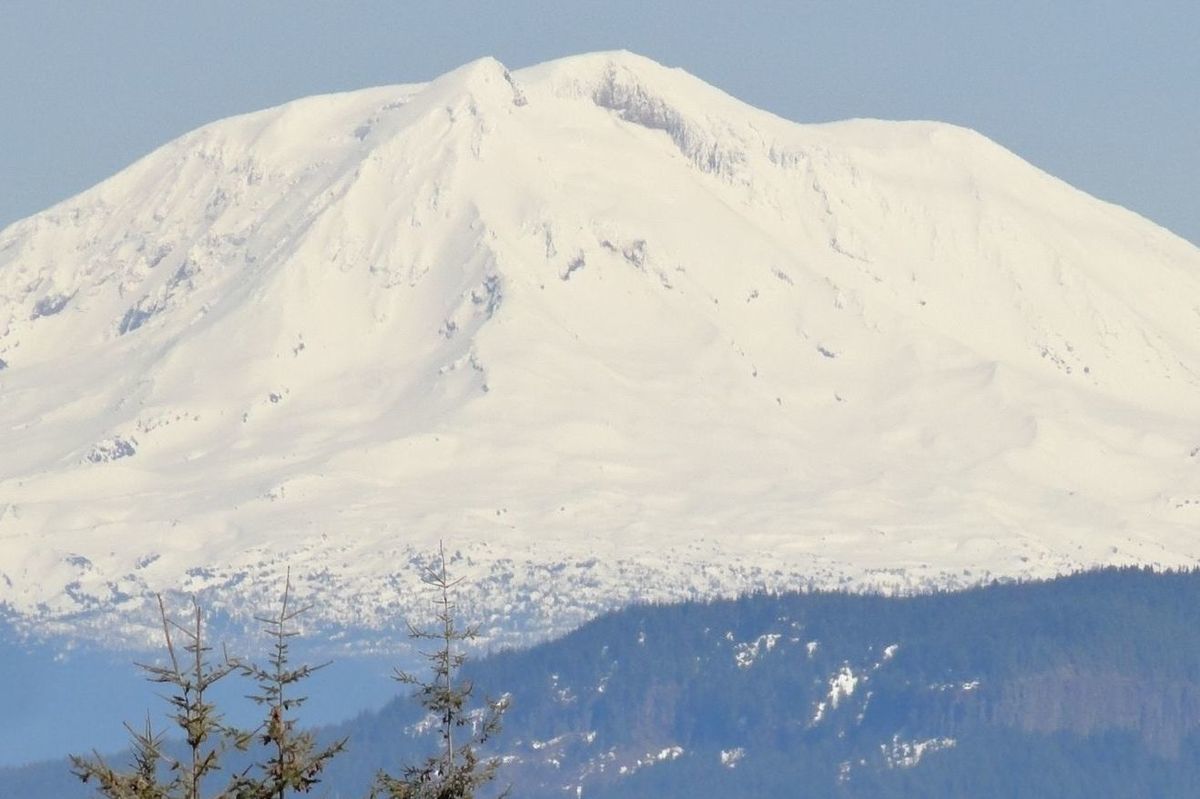
Trail Highlights: non-motorized ski and snowshoe trail, old-growth forest, Mount St Helens and Mount Adams views, June Lake Snotel.
Directions to Trailhead: From Woodland (Exit 21 on I-5) follow SR 503 east for 29 miles to Cougar. Then continue east on SR 503 (which becomes FR 90) for 7.0 miles turning left onto FR 83. Follow this good paved road 6.0 miles to the large Marble Mountain Sno-Park.
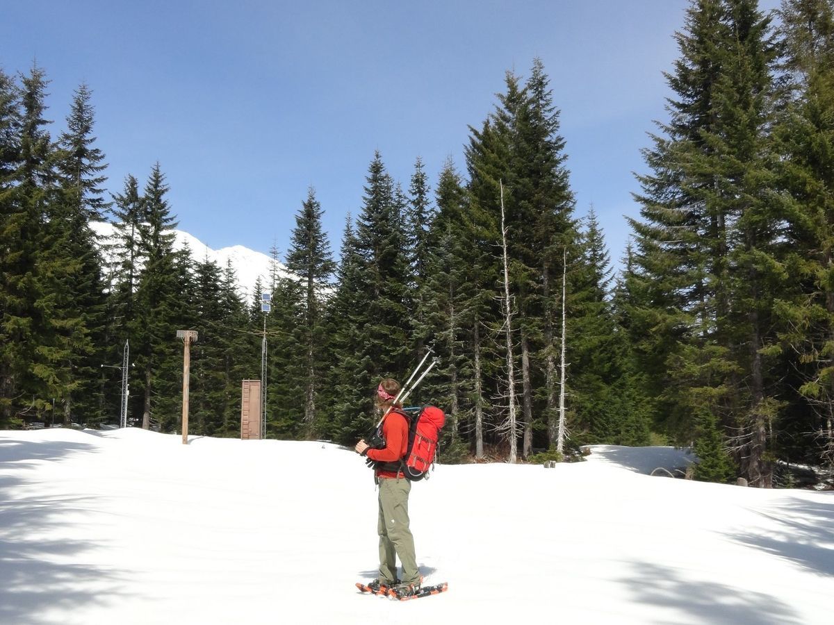
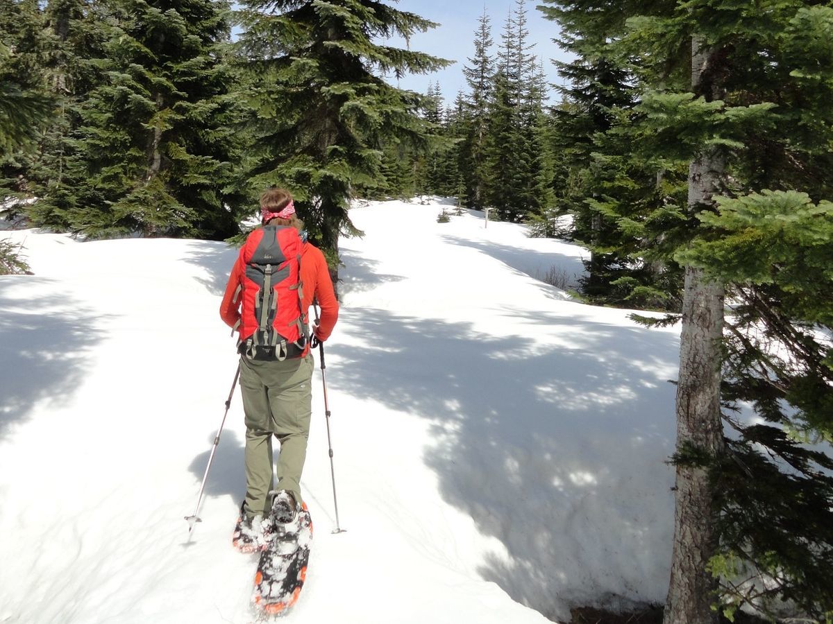
Looking for a good network of ski and snowshoe trails near Mount St Helens that are easy to get to, situated safely away from avalanche zones, and offer varied and family-friendly terrain? Then head for the Pine Marten and Sasquatch Trails located on the southern flank of St Helens. The trails are accessed from the popular and large Marble Mountain Sno-Park. You’ll be starting on your adventure with snowmobilers heading to Marble Mountain and the Lahar flats as well as climbers and skiers heading up the snowy volcano. But things quiet down once you reach the trails named after the Northwest’s most mystical and elusive entity.
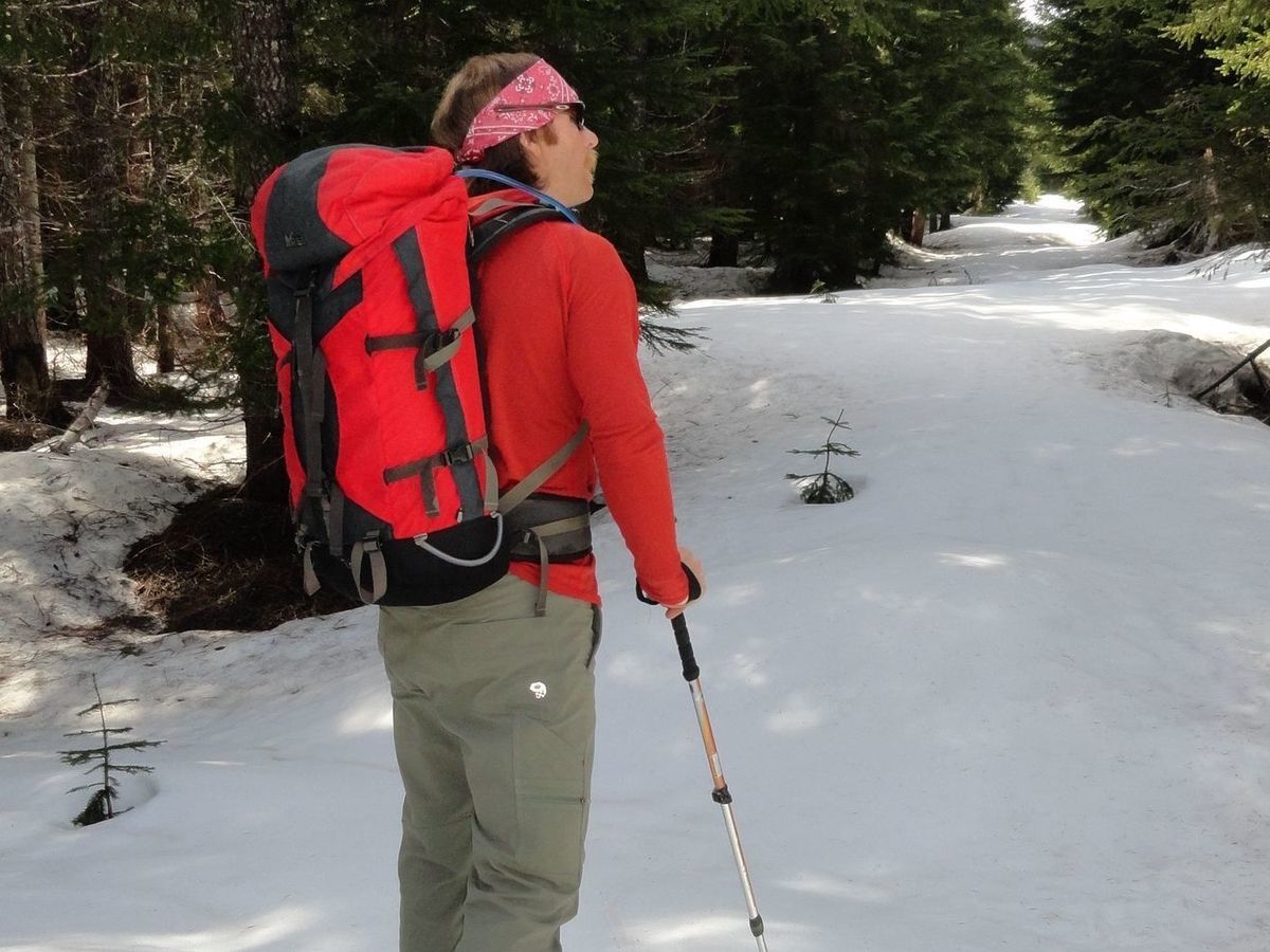
While the Sasquatch Trails are open to both skiers and snowshoers; if you’re snowshoeing, remember not to walk in ski tracks. The trails are on old roads, so they’re fairly wide providing plenty of room for everyone. Start by heading east on the occasionally groomed Pine Marten Trail, a great choice for beginning skiers and snowshoers. Immediately cross the West Fork Snowmobile Trail. After a half-mile of gentle walking past the junction with the Marble Loop Trail. Next pass the Rock Pit Trail which climbs to the Swift Creek Trail, which is the winter climbing route up St. Helens.
Continue straight reaching another junction. Here the popular June Lake Trail veers left and along with it many of your fellow snowshoers and skiers. Stay on the Pine Marten Trail to traverse a meadow with views of St Helens and cross a branch of Swift Creek. At 1.8 miles, reach a junction with the Sasquatch Trails. Now head left here moving farther away from the noise of the snowmobile route along FR 83. At 2.2 miles come to a junction.
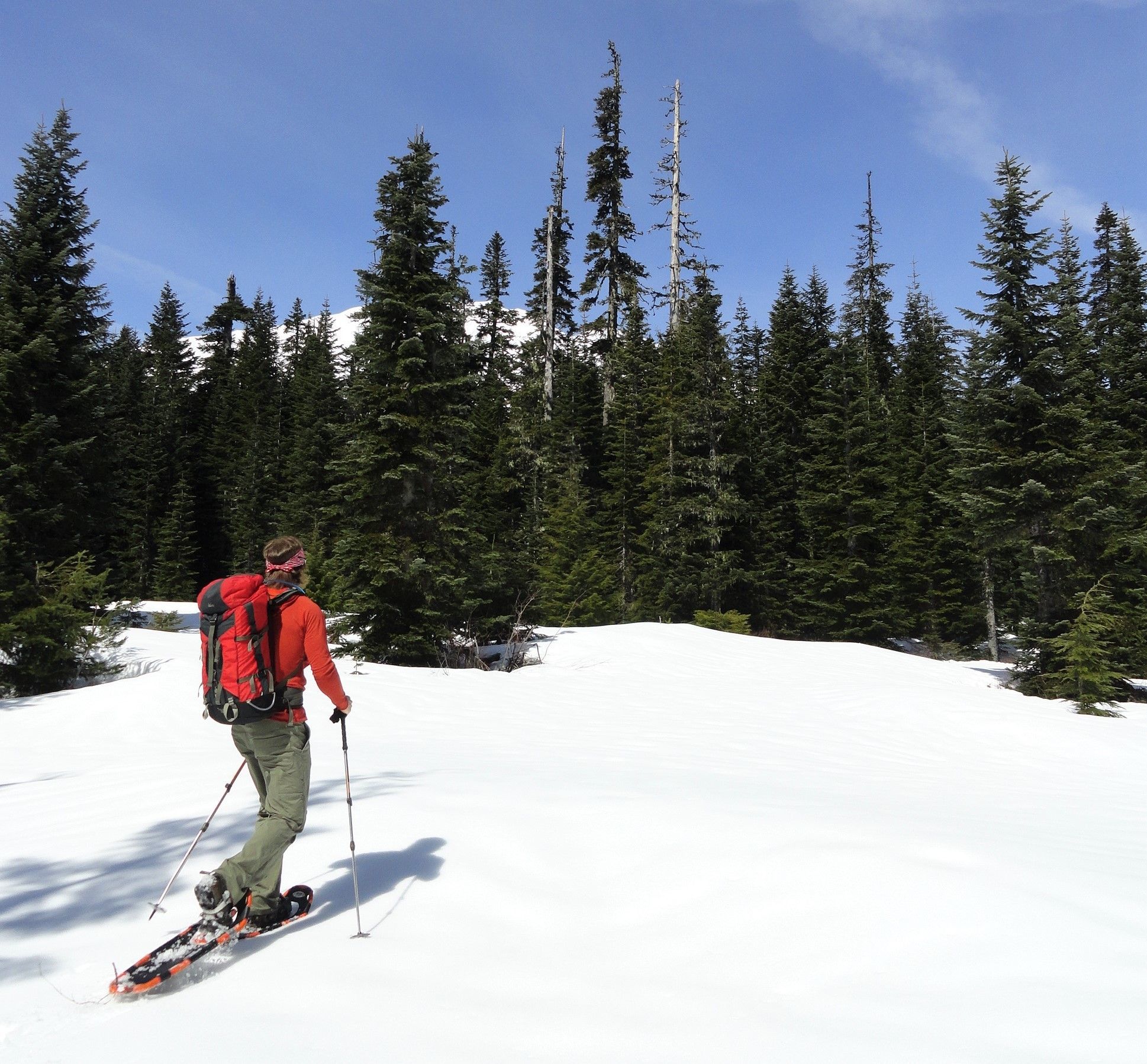
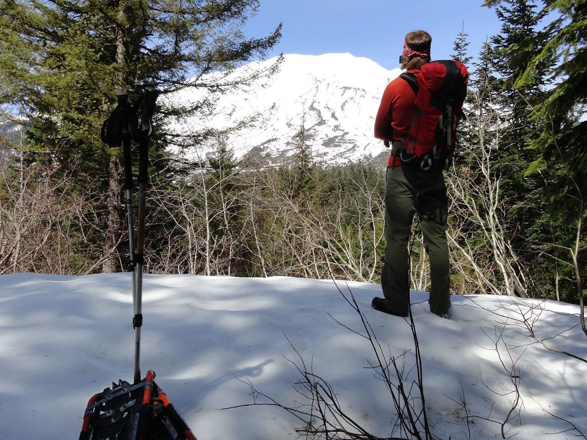
The Sasquatch Connector heads straight connecting back with the main Sasquatch Trail before terminating at the snowmobile trail on FR 83. For the recommended loop, head left and start climbing coming to a junction with the Middle Sasquatch Trail at 3.0 miles. This suggested loop has you returning on that trail, so continue left on the main Sasquatch Trail ascending a small ridge above June Lake. En route traverse open forest providing views of Mount St Helens and the Indian Heaven Wilderness peaks.
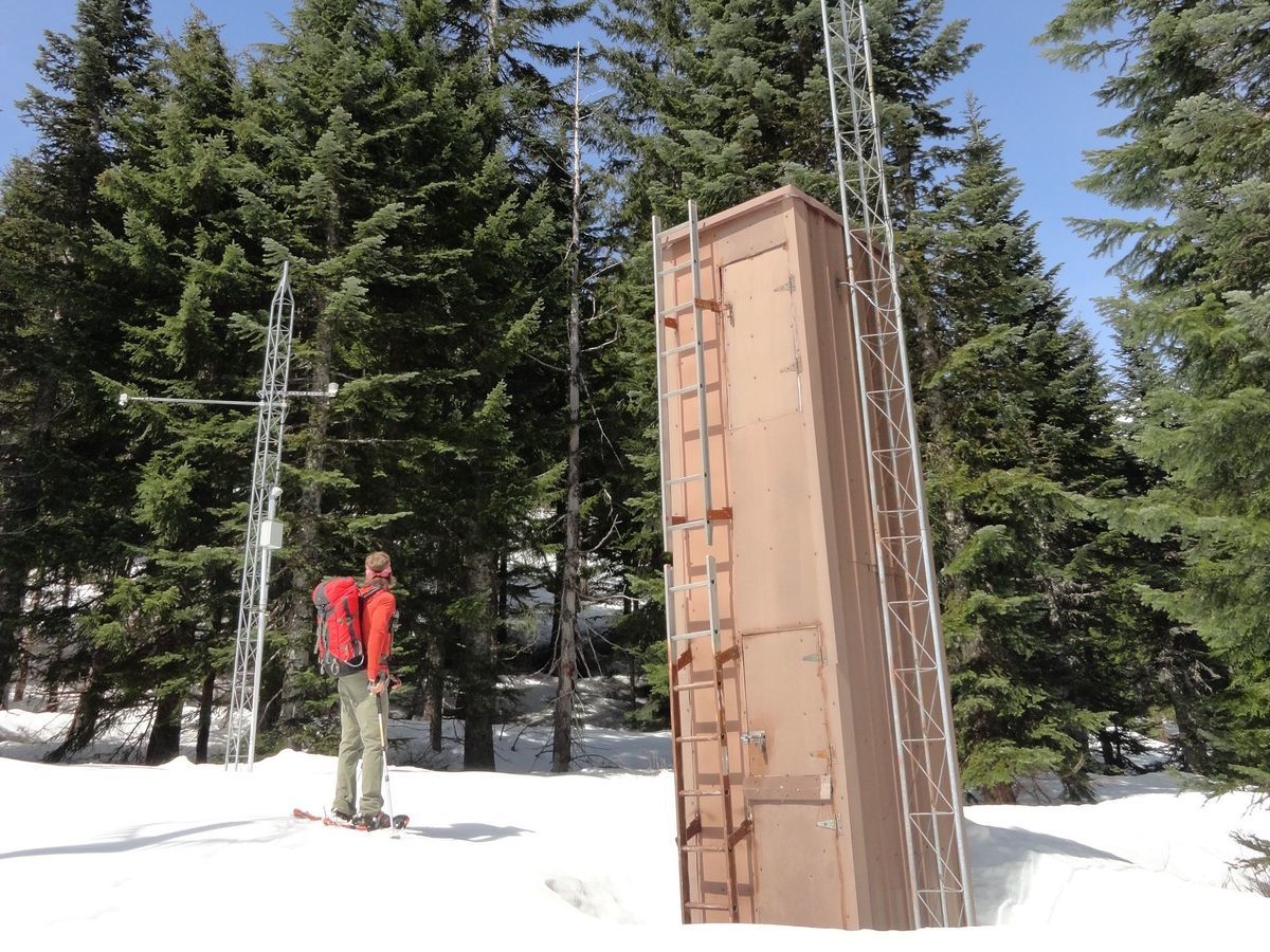
Soon come to an odd structure—the June Lake Snotel. Check it out but don’t disturb it. It’s one of many stations throughout the American West that uses automated sensors to measure snowpacks and predict water supply forecasts. There are more than 700 of them in 11 states. Washington has more than 70 locations throughout the Cascades; and a handful in the Olympic Mountains, Blue Mountains, Selkirk Range, and Okanogan Highlands. They are operated by the Natural Resources Conservation Service (NRCS) .
The Snotel sites measure snow water content, accumulated precipitation, air temperature and many other data used to forecast water supplies and for climate research. Most of the Washington sites also measure snow depth—and if you’re an outdoor recreationist intent on doing some winter wandering—that reading will probably be of most interest to you. Most of the sites are in remote areas and not easily accessible—or in areas of restricted access. So, there’s a good chance that you’ve never come upon one.
Now continue on the trail west through meadows before swinging north passing a good view of St Helens. The way then bends east traversing pocket meadows and reaching an elevation of about 3475-feet before gently descending through mature forest and reaching an old road junction. It’s possible to follow the old track left towards the Worm Flows. The trail however follows the track right through an old harvest area reaching a junction at 6.0 miles.
You can continue straight 0.3 miles to a junction with the Sasquatch Connector and then turn right for a shorter loop. But it’s more interesting to turn right here and continue on the Middle Sasquatch Trail. Now gradually ascend through open forest and wetlands passing some decent views of Mount St Helens and one good view of Mount Adams. At 6.9 miles reach a familiar junction with the main Sasquatch Trail. Turn left and head downhill back to the Pine Marten Trail and then back to your start at the Marble Mountain Sno-Park for a grand lollipop loop just shy of 10 miles.
Trail Resources:
Map: Green Trails Mount St Helens 332S
Guidebook: Day Hiking Mount St. Helens by Craig Romano and Aaron Theisen (Mountaineers Books)
Managing Agency: Mount St Helens National Volcanic Monument
http://www.fs.usda.gov/main/mountsthelens
Craig Romano is an award-winning author of more than 25 guidebooks with Mountaineers Books. One of the most prolific trails writers in Washington, he has hiked more than 30,000 miles in the state from the Olympics to the Blues. Visit him at CraigRomano.com