
SEARCH
Roundtrip: 4.0 miles
Difficulty: moderate
Elevation Gain: 1250 feet
High Point: 2383 feet
Best Season: year-round
Trail Notes: NW Forest Pass or Inter-agency pass required
Practice leave no trace principles.
Trail Highlights: historic forest fire lookout site, good views of Wind River Valley, solitude, hike through historic Wind River Nursery
Directions to Trailhead: From Stevenson, head east on State Route 14 for 3.2 miles, turning north at the traffic circle onto Wind River Road. Then drive 8.6 miles and turn left onto Hemlock Road. After 1.2 miles (just beyond the Wind River Work Center), turn right onto Forest Road 43. Proceed for 0.7 miles and turn right onto FR 417. Continue for 0.3 miles passing the PCT (no parking) to a large parking area for the Whistle Punk Trail.
There is nothing revolutionary about this small 2383-foot igneous volcanic plug just north of Carson in the Wind River Valley. Named by early valley settlers, M. McGinty and B. Tillotson for the hill in Boston of American Revolutionary War Fame, this little standalone peak is one of more than 80 peaks across the country named after the famous Bunker Hill. And while the Colonists lost to the British at that battle—and it actually took place at Breeds Hill, not Bunker Hill, the Battle of Bunker Hill has been indelibly etched into our American psyche. It was a Pyrrhic victory for the British and a rallying call for the colonists that they could stand up to a much larger force ultimately leading to their prevailing. So why not name a bunch of hills and mountains across America after the Bunker Hill?
Skamania County’s Bunker Hill stands at just shy of 2400 feet and is a small igneous volcanic plug. Volcanic in origin, but no Mount St Helens or Mount Adams. Bunker Hill pushed up between 20 and 25 million years ago through even older layers of volcanic flows. But it’s surrounded by much younger basalt flows from the nearby and larger Trout Creek Hill. This small shield volcano had a substantial impact on the Wind River Valley sending basalt flows all the way to the Columbia River.
While Bunker Hill isn’t as geologically significant as Trout Creek Hill, and there were no major historic events on it—this little peak is a great place to capture some of the area’s early 20th-century national forest history. And with its well-maintained trail, it’s an excellent place to take a hike in the Wind River Valley. And while the PCT lies within its shadows—this little peak sees very little use—making it perfect for wildlife viewing and a little alone time in nature. There are some old-growth trees and a few views along the way, too.
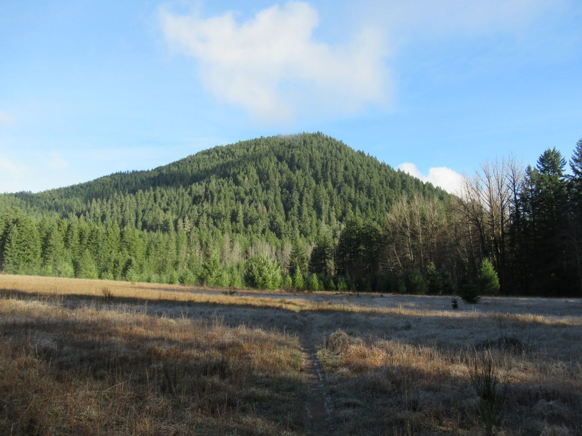
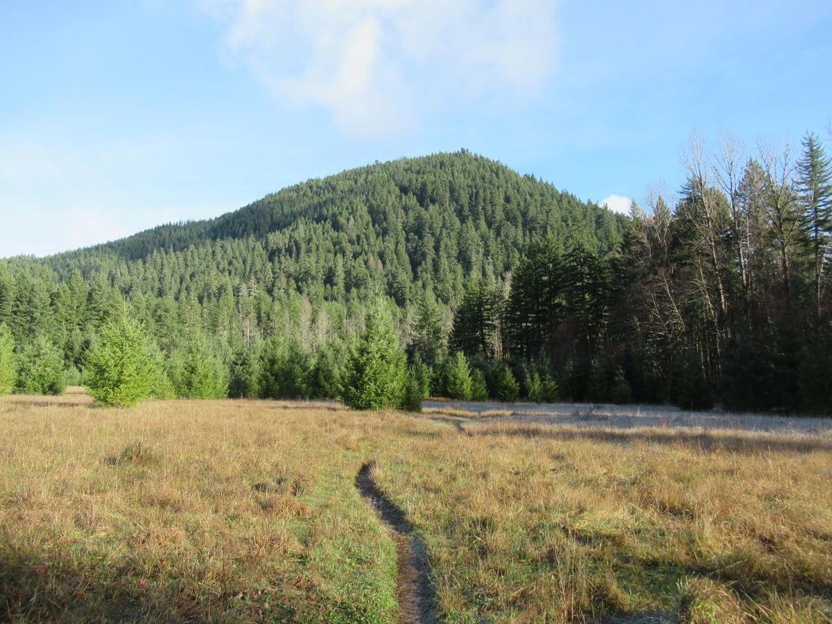
Start your hike by walking east on FR 417 for 0.2 miles back to the PCT, following along a fence line of the defunct Wind River Nursery. The Nursery was established in 1909 by the fledgling U.S. Forest Service at the then Columbia National Forest (now Gifford Pinchot NF) to produce trees to reforest and rehabilitate large fire-denuded areas. The nursery grew into one of the largest federal nurseries in the country. Seedlings grown here were planted all over the Northwest. Sadly, the nursery closed in 1997 and many of its structures fell into disrepair. Since 2020 volunteers with the Wind River Trust have been working hard to rehabilitate many of the historic buildings on the former nursery and adjacent experimental forest.
Now follow the PCT north across the fallow nursery. Heavily forested Bunker Hill rises before you. Elk and deer frequent the meadow you’re traversing. Soon enter forest and hike across a marshy alder and maple flat and pass a lone big Douglas-fir. At 0.6 miles from the trailhead come to a junction with the Bunker Hill Trail. Turn left and take it steadily climbing via a series of switchbacks.
While Bunker Hill is small in stature, it does require a decent climb to get to its summit. The way traverses steep forested slopes with patches of beautiful old-growth Douglas-fir. In 1902 much of this area went up in flames in the Yacolt Burn. The remnant old-growth survived the conflagration. The uniform forest enveloping the ancient pockets is now a century old.
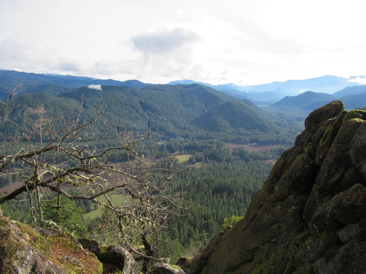
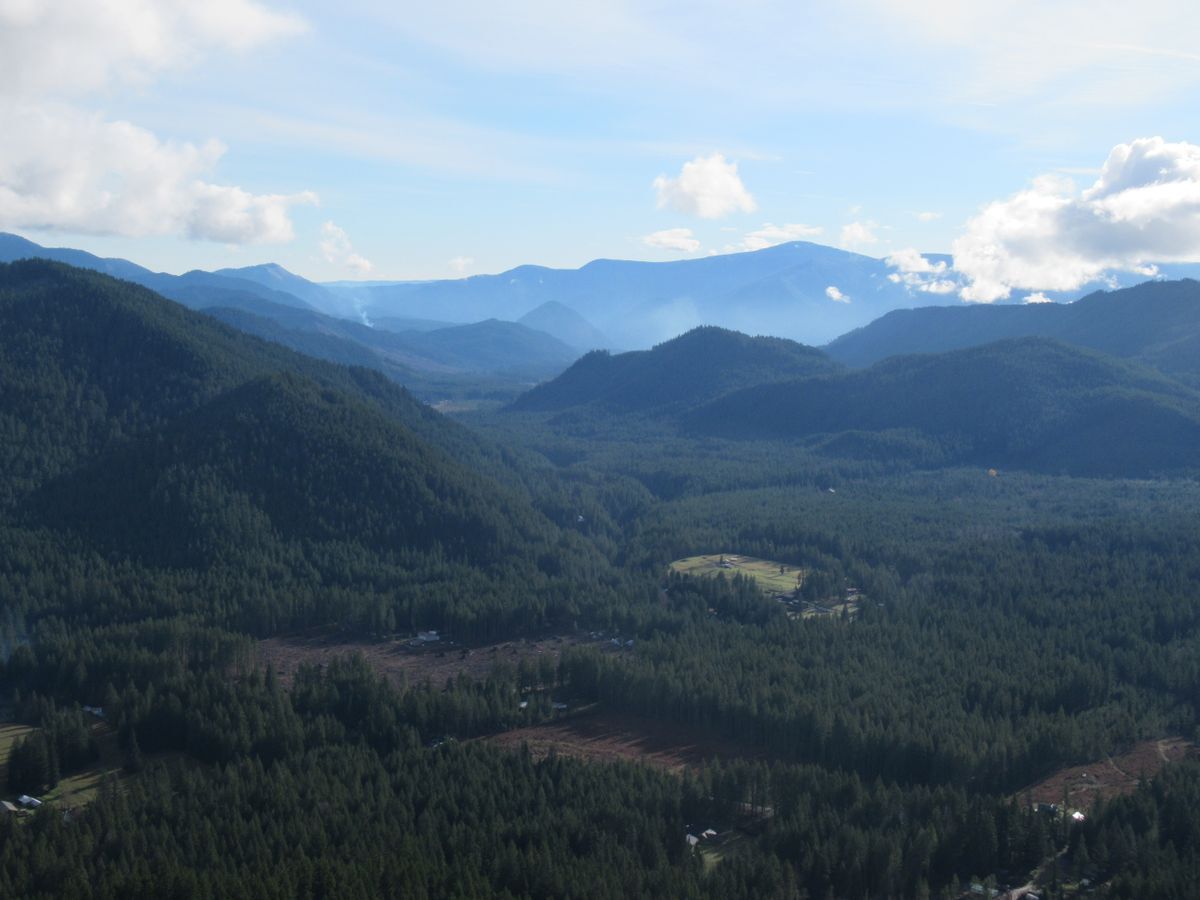
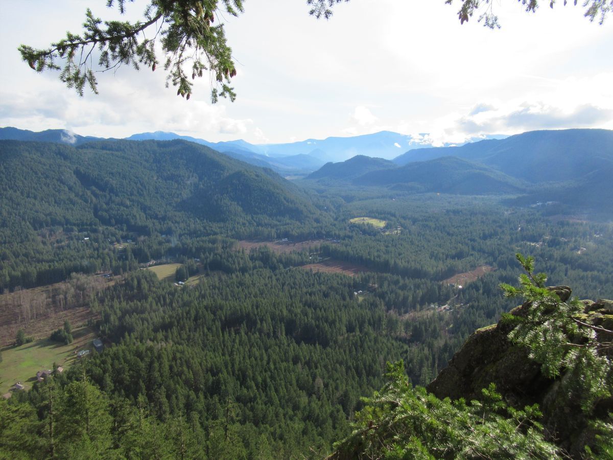
At 1.8 miles the trail skirts a small set of ledges. Carefully work your way toward them for a good view down the Wind River Valley to the Columbia River with Oregon’s Mount Defiance dominating the backdrop. Enjoy views too of Dog Mt, Wind Mt, Augspurger Mt, and Big Huckleberry Mt. Look to the northeast to catch a glimpse of the snowy top of Mount Adams.
Continue hiking upward for another 0.2 miles reaching Bunker Hill’s 2383-foot summit enveloped in thick forest. In May of 1933 the first Civilian Conservation Crop (CCC) camp in Washington, Camp Hemlock was established close to the base of Bunker Hill where the old ranger station now stands. Among the CCC enrollees’ duties in the area were building fire lookouts. They constructed a rudimentary lookout cabin on Bunker Hill in 1934 when most of the peak was shrouded in burnt timber and silver snags. Views were wide in every direction.
In 1940 the Corp built a more solid structure in the form of a small tower. The CCC was terminated in 1942 during World War II. Camp Hemlock then briefly served as a camp for a small group of conscientious objectors. From March 9, 1942 until October 15, 1943 the fire lookout was used as an Aircraft Warning Service Station as part of the war effort. After the war the tower reverted back to a fire lookout and remained in operation until the 1950s. All that remains of the fire lookout today are the concrete blocks that anchored it—and a fascinating history. After your hike, plan on exploring some of the nearby Wind River Historic District.
Trail Resources:
Map: Green Trails Wind River No. 397
Guidebook: Day Hiking Columbia River Gorge by Craig Romano (Mountaineers Books)
Managing Agency: Gifford Pinchot National Forest, Mount Adams Ranger District, Trout Lake, (509) 395-3400, www.fs.usda.gov/giffordpinchot