Learning Resources
Blogs
Hiking the Family-Friendly and Shady Ape Canyon Trail
Jessica Becker
Pubished - August 11, 2025
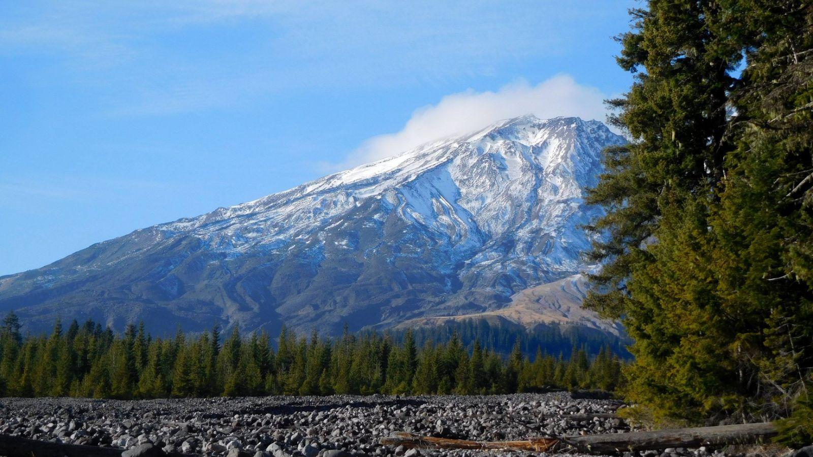
You’ve probably heard of Ape Cave, but have you heard of its neighbor, Ape Canyon? This spot on the southeast side of Mt. St. Helens was named after a famed altercation between early 1920s miners and supposed ape-like creatures (aka Bigfoot). Thankfully, I’ve only encountered epic views, awesome trees, and a few biting insects when I’ve hiked the trail!
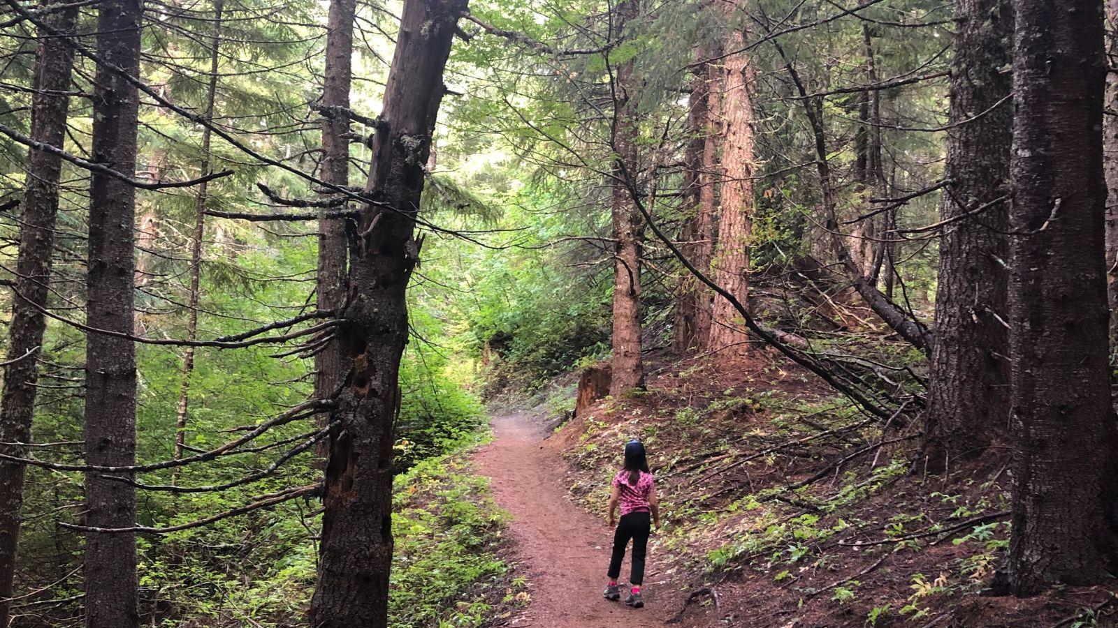
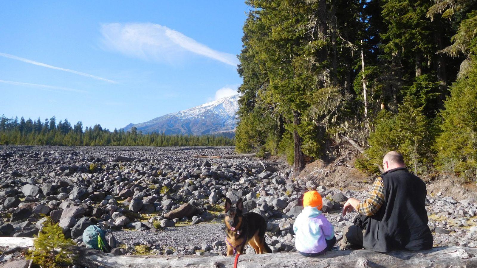
It’s an 8+ mile round-trip hike with quite a bit of elevation gain to get to the edge of the canyon, but the Ape Canyon trail is still fantastic for a family hike. In the summer, the big forest provides lots of shade, but you still get good views of the volcano and the Muddy River lahar. The fall season is also quite lovely due to changing fall leaves and colorful mushrooms (look, but don’t touch)!
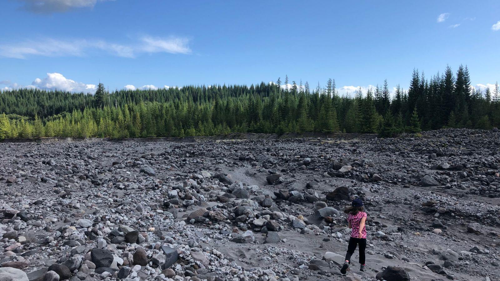
So, what is a lahar anyway? A lahar is essentially a mud/debris/rock flow that originates on a volcano. The Muddy River lahar was formed when Mt. St. Helens erupted on May 18th, 1980. The eruption caused rocks, water, and debris to race down the Muddy River, which originates high up on the volcano. The rock field you see from the trail is what is left of this event. One thing I love about this trail is that even though the forest had a front row seat to this show, it wasn’t really affected.
Trail Description
From the trailhead to the turnaround point, you’ll be steadily climbing in lovely woods. After a little bit of hiking, the trail will travel right next to the Muddy River lahar. There are a few places where you can hop out into the lahar to get a nice view of Mt. St. Helens. Watch your footing and don’t get too far from the trail. In the lahar’s soft ash/rock, you may find the tracks of animals like elk, so be sure to look down from the awesome views on occasion.
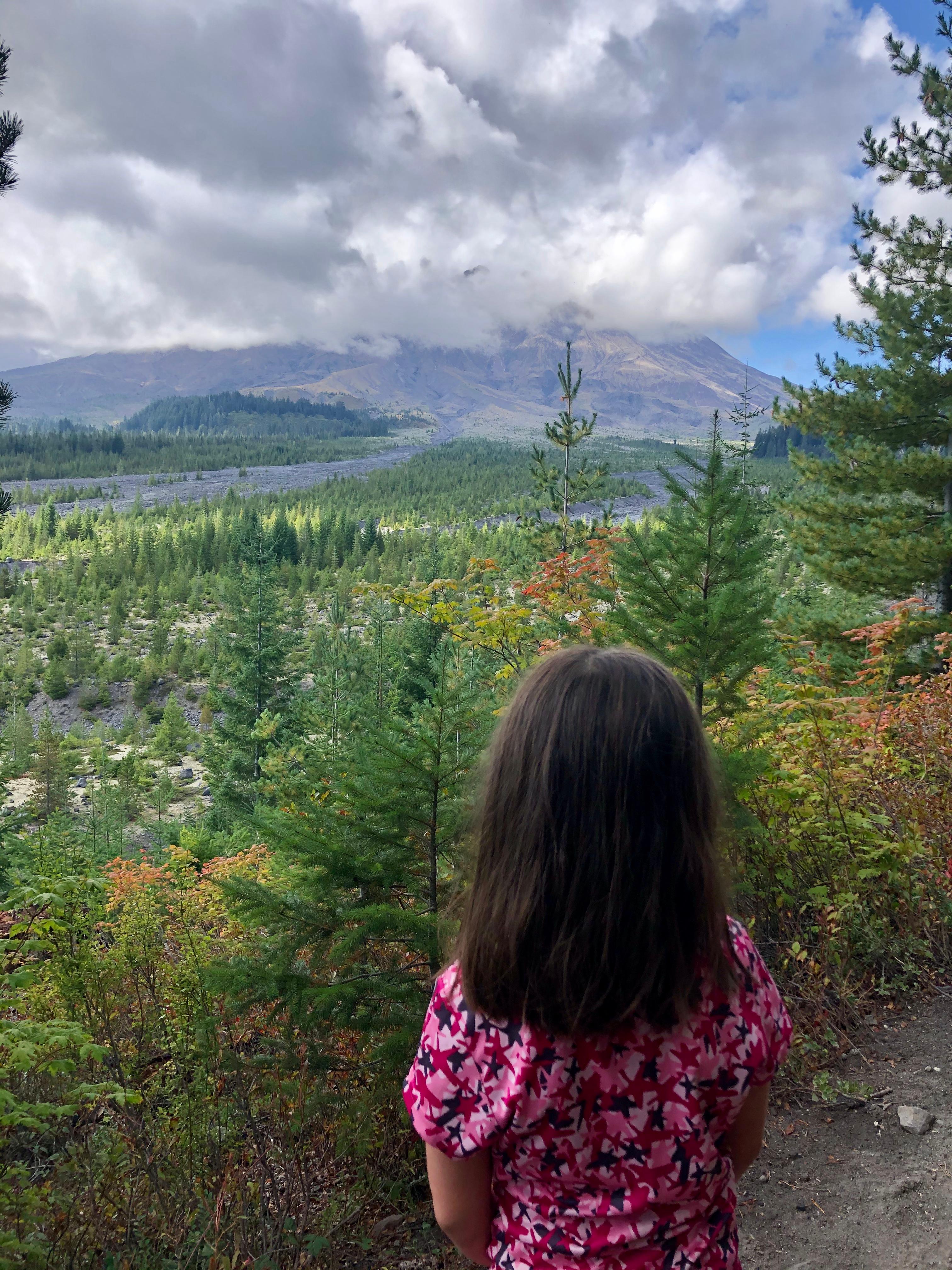
At about 0.5 mile into your hike, the trail narrows and becomes cliffy (there is a little brush between you and the cliff, but not much). There is a good view of the volcano here, and you will want to keep kids away from the edge. This section is short-lived and you’ll be back in the woods and away from the cliff edge soon.
At around 3,250 feet of elevation and 1.5 miles into your hike, you will enter some lovely old growth forest. This can be hard to come by in the Mount St. Helens National Monument, so be sure to travel a bit through this section to admire the big trees. At about 1.8 miles into your hike, you will come to a set of switchbacks in the trail (this means the trail is built in a zigzag pattern to minimize the uphill slope). Hike to the top of the last switchback for a sense of accomplishment and a 3.6 mile round-trip hike with around 800 feet of elevation gain. This is a great place to turn around when hiking with kids. Beyond this, the trail continues to climb through woods for over 2 miles before reaching the Loowit Trail.
Other Things to Note
- The Ape Canyon trail is a great place to hike when you’re looking for shade or it is too cloudy to see the volcano. Be prepared for cooler temps on this trail, especially when the seasons are changing. There is no water available on this trail, so make sure you bring extra. It is always important to come prepared, but especially due to the conditions on the south side of the mountain. Check out this post on safety.
- Walking on the lahar area will expose you to hot rocks, full sun, and unstable footing. Do not venture far from the trail so that you can avoid getting lost or hurt. You may encounter some mosquitoes or biting flies on the trail in spring and early summer. This trail is shared with mountain bikes. It is advised that folks hiking on Mt. St. Helens check for volcanic activity before heading out.
- Dogs are allowed on the trail. Please clean up after them and do not leave poop bags on the trail.
- The road to the trailhead is paved, but it may have rough spots. Drive slow to avoid unexpected bumps. A parking pass is required.
- There is no cell service for a long time accessing this trail. Have offline maps available to you, as well as directions. If you would like to purchase a map, I recommend National Geographic Trails Illustrated Map: Mount St. Helens - Mt. Adams, Green Trails Map: Mount St. Helens, WA #364, or Green Trails Map: Mount St Helens National Volcanic Monument, WA #332S. You can also create and download a map here. Input these coordinates into the search bar: 46.165691, -122.092332.
- Gas, food, and water are available in Cougar 17.8 miles away. Cell service is spotty in Cougar, but some of the stores in Cougar may have guest wifi available.
Recommended Extra Gear
Remember to bring:
- Extra food and water
- 10 essentials
- Sun protection
- Full tank of gas
- A good map and clear trailhead directions
- Extra layers in case of cooler temperatures.
Read more in this safety and gear guide for families.
Toilets
There are vault toilets available at the nearby Lava Canyon trailhead (learn more here). The closest public flush toilets are located in Cougar behind Cowlitz-Skamania Fire District #7 Station 72.
Potential Add-On
Consider stopping at the nearby Lava Canyon Trail and Lahar Viewpoint.
Getting to the Trailhead
The trailhead is located at around 2,870 feet at these GPS coordinates: 46.165691, -122.092332. This is around 64 miles from Vancouver, WA. From Cougar, WA, drive east on Lewis River Road for 3.1 miles. The road turns into Forest Road 90, and you should stay on it for 3.4 miles. Turn left onto Forest Rd. 83. After 11.2 miles, turn left into the Ape Canyon Trailhead.
About the Author
Jessica Becker is an avid hiker and backpacker, outdoor educator, and homeschooling mom. She is committed to sharing her love of exploring the outdoors on foot with her daughter, who is now in elementary school. Jessica has been hiking with her daughter since she was just a few weeks old, and she has encountered all the phases of hiking with a kid. Jessica has led many families on hikes and is known for blurting out "Did you know?" and trailing off on some educational topic connected to the trail they are on. "little feet hiking" guides are structured in that same way - in addition to getting the details on how to have a safe and enjoyable hike with your kids on a particular trail, Jessica also includes information on hike-specific learning opportunities. Jessica believes that this type of place-based learning helps kids have a more enriching learning experience. Get her books on Amazon or at Vintage Books.
