Blogs
8 Min Read
Hiking the Family-Friendly Ape Cave Surface Trail
Jessica Becker
Pubished - June 04, 2025

You’ve probably heard of Ape Cave on the south side of Mount St. Helens. It’s a really fascinating lava tube with several options for exploration, including a fairly easy trek for families.
Let’s be real, though. Kids can be afraid of the dark, and there isn’t a place much darker than a 2,000-year old lava tube. When I first tried to get my daughter to go into Ape Cave at 2 years old, we didn’t make it far at all. It actually took us a handful of visits before she would finally complete the whole lower cave. Honestly, as someone who doesn’t much care for the dark myself, it was difficult for me as well!
So, what’s a family to do if you reserve and pay for a parking permit, drive all the way to the trailhead, and your kids just won’t go in the cave? Hike the 2.6 mile out-and-back surface trail, of course! And even if you do make it into the cave, the surface trail is still a good add-on as you don’t have to walk far to enjoy it.
My family enjoys the surface trail quite a bit. It’s pretty awesome knowing you are hiking ABOVE a lava tube, not to mention hiking through and along ancient lava flows.
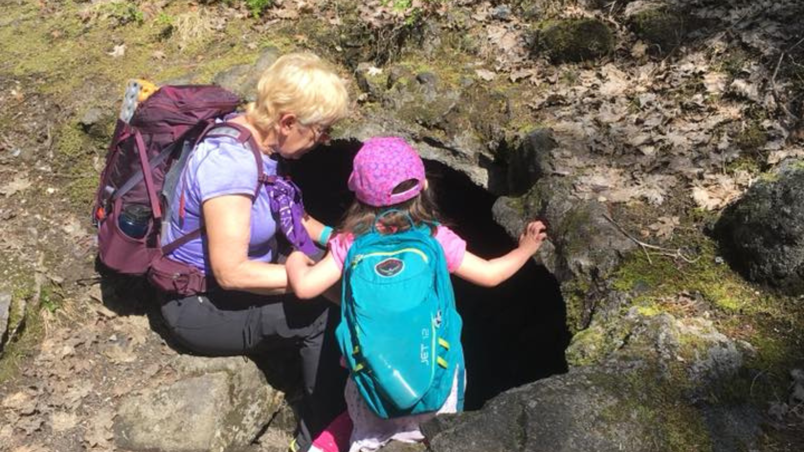
There are cool gaps in the lava rock along the trail that are perfect for peering in while shining a flashlight. The shady forest is quite pretty, and there you may find monotropa plants in the summer and mushrooms in the fall. Outside of the forest, you will find colorful wildflowers like beargrass and penstemon. One favorite spot along the trail is a big hill of basalt (hardened lava rock) that abuts the trail.
A quick note: Ape Cave is a special place. Please follow all rules and leave the area better than you found it. You can learn more about how to protect the cave and general “leave no trace” principles here.
Trail description
Find the paved path next to the Ape Headquarters. Follow this paved (and accessible!) path up to the lower cave entrance and check out the great informational signs by the cave entrance. Continue onto a signed dirt/ash/rock trail.
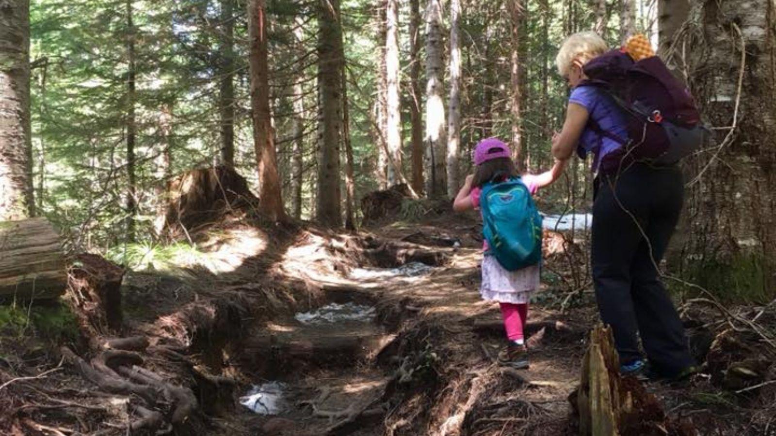
If you look down, you’ll see that you are sometimes walking on an old lava flow. This can be slippery when wet. There are blue diamonds on the trees to mark the trail in snow, but they can also be helpful when there is not snow.
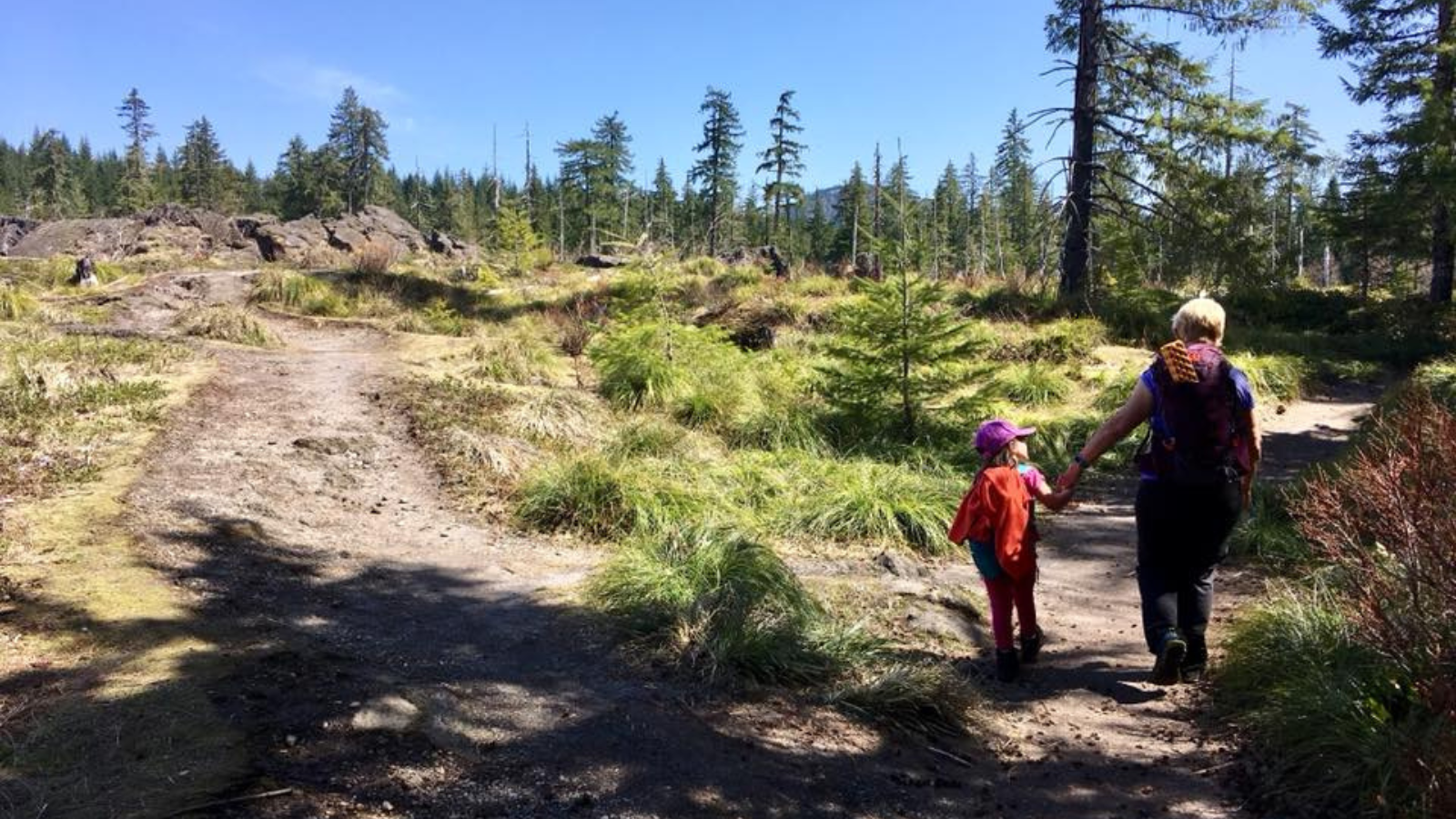
You will cross two creeks that are usually dry in the summer and fall. The trail passes by neat lava rock formations and through mature forest and open sandy/ashy areas. Make sure you stay on the trail to avoid getting lost or falling into a hole.
Towards the end of the hike, you will come to a junction with an old road in a wooded area and go to the left. I would suggest having an adult in the front as you move out of this wooded area.
Not long after this, you will come to the turnaround point, which is the upper cave entrance/exit. It really is just a hole in the ground with a ladder. This route is 2.6 miles round-trip with about 365 feet of elevation gain. Even walking a mile round-trip hike on the trail is worthwhile!
If you’d like to extend your hike, you can hop onto the 1.6 mile round-trip Volcano View Trail or pop into the cave. You can learn more about the kid-friendly Volcano View Trail in Jessica’s first book little feet hiking: 25 confidence-building hikes for little kids around Vancouver, Washington.
What is this place anyway?
Ape Cave is the country’s third longest lava tube and is 2.5 miles long. During its formation, Ape Cave was essentially a river of lava. The sides of the lava flow slowly cooled and formed a roof over the lava flow. When the lava stopped flowing and drained from the tube, the cave was left behind.
The lava tube and the above ground lava flow were a result of a volcanic eruption that occurred almost 2,000 years ago. Geologists named this flow the “Cave Basalt Flow” because this eruption formed over 60 lava tubes (caves) in the area. It is thought that the eruptions occurred over a period of a few months to almost a year.

The area above the tubes would have been wiped out, but the forest eventually returned. The rock that you see on the trail is basalt, which is a volcanic rock that is gray or black in color. Basalt is the most common rock type in the Earth’s crust and most of the ocean floor is made up of basalt. As you hike, note the different textures of lava rock you encounter. Some look kind of flowy, while others look like they are full of air.
Other things to note
- It is always important to come prepared, but especially due to the conditions on the south side of the mountain. Check out this post on safety.
- The trail leads you through shade and full sun. Know that hiking through the lava flows can be extra hot. It is important to bring extra water and sun protection, as well as time your hike during the cooler parts of the day. You may encounter some mosquitoes or biting flies in spring and early summer. Lava flows next to the trail can be sharp and the holes in the rocks can be deep. Rock on the trail may be slippery when wet. Be sure to stay on the trail and watch your step. GPS sometimes does not work in lava fields; it is advised that folks hiking on Mt. St. Helens check for volcanic activity before heading out.
- The parking area requires an advanced parking reservation, even if you do not intend to enter the cave. You cannot purchase parking onsite, and there is no cell service. The parking area and trails are only open May 18 to October 31. You never know what kids might be up for, so come prepared for at least a short trip inside the lower cave (bring warm clothes and flashlights/headlamps in case). I do not believe the upper cave is appropriate for most kids. Please come prepared and understand there are two different possible routes (the easier out-and-back route in the lower cave, and the difficult and longer one-way trip through the upper cave). Please observe all instructions on protecting the resident bats from white-nose syndrome, and talk to your kids about this (see information on signs onsite). Plan to practice “leave no trace" principles. The cave is cold, damp, and slippery year-round. Find out more about reservations and the cave. In addition to the reservation fee, a NW Forest Pass or America the Beautiful Pass is required to park. Find out more on all of this here.
- Dogs are allowed on the surface trail, but they are not allowed inside the cave. Please do not leave your dogs in the car while in the cave. You will want to consider their feet on the sandy/ashy/rocky/hot trail surface. Please clean up after them and do not leave poop bags on the trail.
- There is no cell service for a long time accessing this trail. Have offline maps available to you, as well as directions. If you would like to purchase a map, I recommend Green Trails Maps: Mount St. Helens, WA #364 or Mount St Helens National Volcanic Monument, WA #332S. You can also create and download a map here. Input these coordinates into the search bar: 46.108883, -122.211518.
- Gas, food, and water are available in Cougar 9.3 miles away. Cell service is spotty in Cougar, but some of the stores in Cougar may have guest wifi available.
Recommended extra gear
Remember to bring:
- Extra food and water
- 10 essentials
- Sun protection
- Full tank of gas
- A good map and clear trailhead directions
- Extra layers in case of cooler temperatures.
- Two sources of lights and warm layers for the cave if you decide to go inside. Flashlights can also be fun for checking out any holes in the lava field you find.
Read more in this safety and gear guide for families.

Toilets
There are vault toilets available at the trailhead. The closest public flush toilets are located in Cougar behind Cowlitz-Skamania Fire District #7 Station 72.
Potential add-on
Consider stopping at the Trail of Two Forests Interpretive Site on Forest Road 8303. There is an accessible boardwalk and a small lava tube that kids (and some adults) can crawl through.
Getting to the trailhead
The trailhead is located at around 2,100 feet at these GPS coordinates: 46.108883, -122.211518. This is around 55 miles from Vancouver, WA. From Cougar, WA, drive east on Lewis River Road for 3.1 miles. The road turns into Forest Road 90, and you should stay on it for 3.4 miles. Turn left onto Forest Rd. 83, following signs for Ape Cave. After 1.7 miles, turn left onto Forest Rd. 8303. After 0.9 mile, turn right into the Ape Cave Interpretive Site parking area.
About the Author
Jessica Becker is an avid hiker and backpacker, outdoor educator, and homeschooling mom. She is committed to sharing her love of exploring the outdoors on foot with her daughter, who is now in elementary school. Jessica has been hiking with her daughter since she was just a few weeks old, and she has encountered all the phases of hiking with a kid. Jessica has led many families on hikes and is known for blurting out "Did you know?" and trailing off on some educational topic connected to the trail they are on. "little feet hiking" guides are structured in that same way - in addition to getting the details on how to have a safe and enjoyable hike with your kids on a particular trail, Jessica also includes information on hike-specific learning opportunities. Jessica believes that this type of place-based learning helps kids have a more enriching learning experience.
