Volcano Explorers
Since 2008, this school program has brought live, interactive video presentations by preeminent scientists and educators to students across the country. Using webinar technology, Volcano Explorers works in just about any classroom with a computer, projector and internet connection.
About Volcano Explorers
Who
|
Any interested classes! (Presentation targeted to Grades 5-8) |
What
|
A series of 3 interactive webinars. Join us for one or all three!
Learn more about presenters and what they will be talking about here.
|
When
|
3 dates, all at 10-11 am PST
- March 6, 2018: How can we measure a mountain?
- March 13, 2018: Eruption forecasting: Scientific teamwork makes the best interpretation possible
- March 20, 2018: What can we learn from rivers of mud?
|
Where
|
Anywhere in the world with access to a computer, projector, and internet! |
Why
|
This is your chance to interact with real scientists who work at volcanoes! |
How
|
This is a FREE program! Volcano Explorers is hosted through Nepris, an online platform that connects teachers and students with the right industry experts, virtually without having to spend much planning time or leaving the classroom while providing an effective way for companies to extend education outreach and create equity of access. You will need to create an account to sign up.
How to Sign Up for Volcano Explorers
- Go to nepris.com and sign up for an account.
- After you create your account, you can sign up for Volcano Explorers!
- Since this is a special series on Nepris, all 3 Volcano Explorers Industry Chats are FREE for EVERYONE. When you sign up for one session you will be automatically signed up for the other two as well so that you have the option to participate in all three! Please note that if participated in Volcano Explorers last year, you can still participate for free. Please contact Melinda Perez at melinda@nepris.com. We can't wait to have you join this exciting and enriching learning opportunity!
- To find and sign up for Volcano Explorers sessions, you can search for Volcano Explorers or go directly to the sessions by clicking on the links below!
- After you sign up for Volcano Explorers, you will receive an email from Nepris with further instructions.
- Review the Educator Tip Sheet for Day of Session to help you know what to expect.
- If you are joining via an tablet, smartphone, make sure you have downloaded the Zoom Cloud Meeting app at: http://nepris.zoom.us.
- Please sign in sign in 5 - 10 minutes early if you can to be ready to start the session on time.
|
2018 Presenters
March 6, 2018
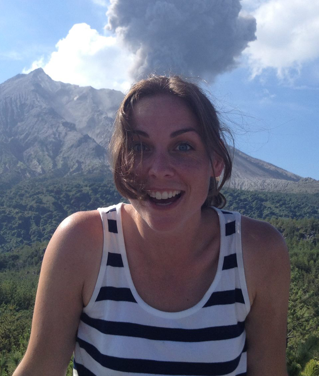
Angie Diefenbach, Geologist, USGS Volcano Disaster Assistance Program
|
How can we measure a mountain?
During an eruption, it is very important to measure changes at the volcano. We need to know how much lava is coming out, how fast lava domes are growing, and where lava might go next. But volcanoes are big landforms and a tape measure simply isn’t long enough.
We use remote methods like sending in drones to take photographs of lava domes or other features and then combining the photographs using computer software to create digital elevation models that we use to measure changes. The data, along with earthquakes, gas emissions and thermal output, are used to better understand volcanic behavior. This helps us to provide a forecast of what might happen next and the where potential hazards might occur.
Angie will talk about how we can measure changes at the volcano using drones, cameras, and satellite technology. |
March 13, 2018
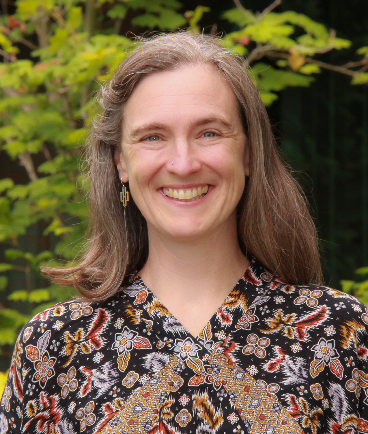
Heather Wright, Geologist, USGS Volcano Disaster Assistance Program
|
Eruption forecasting: Scientific teamwork makes the best interpretation possible
Volcanoes can erupt with devastating consequences. Explosive eruptions can blast rock fragments into the air with tremendous force. Thick lava can build domes that may collapse to form hot, fast-moving clouds of ash and gases. When volcanoes become active, scientists from many different fields work together to interpret monitoring data and make defensible hypotheses about what is going on beneath the surface.
Scientists with the USGS Volcano Disaster Assistance Program work with volcano experts from around the world to study volcano behavior and develop new ways to monitor activity so we can forecast when a volcano might erupt and issue alerts to people who might be affected.
Heather will talk about her experiences working with scientists from other countries to monitor volcanoes and prepare for eruptions.
|
March 20, 2018
Richard (Dick) Iverson, Research Hydrologist, USGS‒Cascades Volcano Observatory
|
What can we learn from rivers of mud?
Debris flows are churning, water-saturated masses of rock, soil and organic matter that rush down mountain slopes. Once a debris flows reaches flatter terrain, it spreads out and slows down, depositing a layer of mud and rocks. Volcanoes are a perfect setting for these events because of their abundance of steep, rocky rubble and a ready source of water in the form of rain, snow or ice. In the past, debris flows have traveled many miles downstream from volcanoes, making this the most threatening hazard in the Cascades.
Dick will talk about how he makes his own debris flows and releases them down a 310-foot-long debris flow flume to study what happens to the flows. He also uses computer simulations to understand how debris flows form and travel. His work is used to assess debris-flow hazards and to help design technologies that are used to mitigate the hazards, including automated detection and warning systems and engineering countermeasures that protect people in high-risk areas.
|
Watch Past Volcano Explorers
JOIN OUR LEARNING LIST
Sign up to get interesting Mount St. Helens updates, lesson ideas, links to volcano news, teacher trainings, and opportunities both on-the-mountain and in-the-classroom.